Yukon River Map
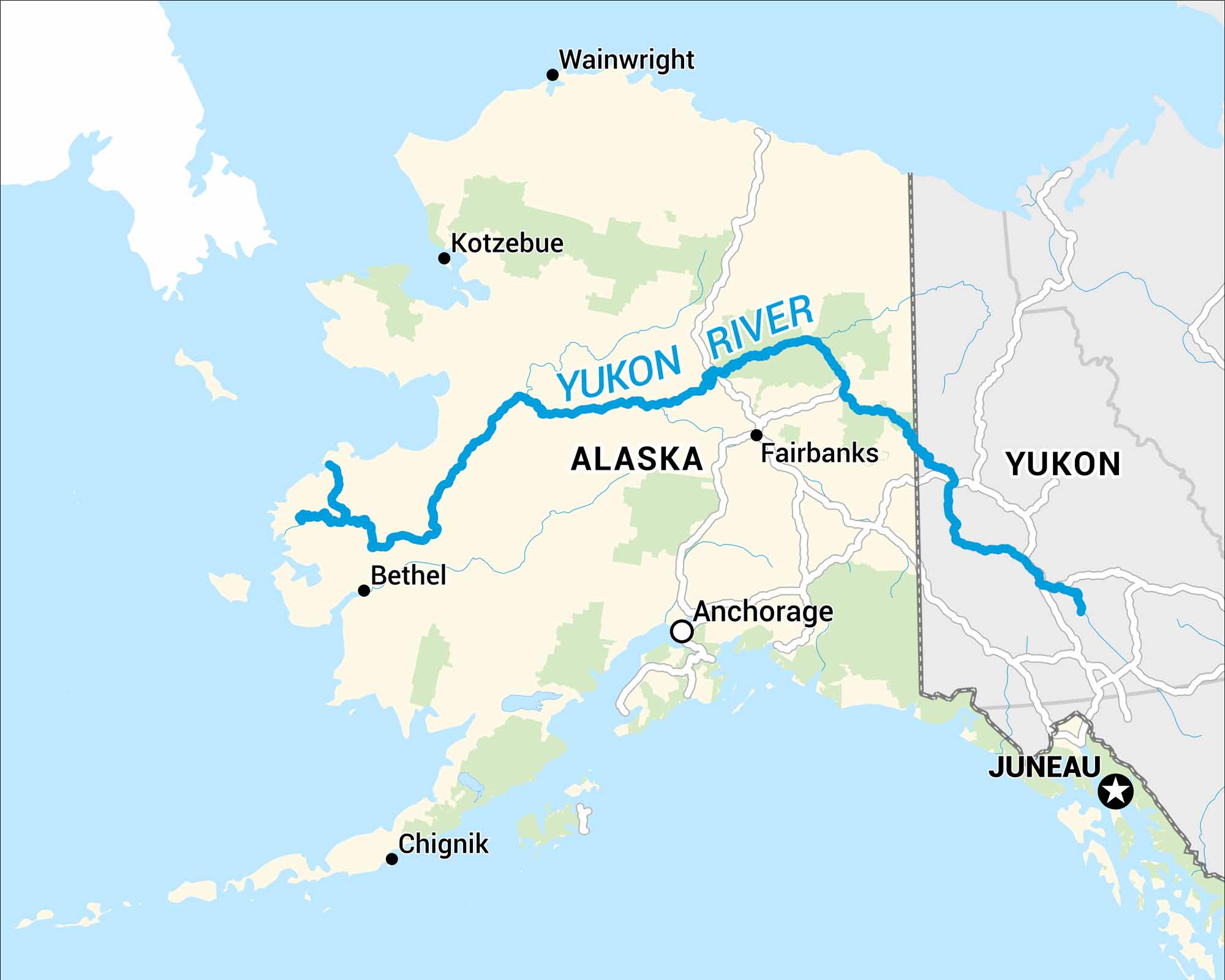
Our map of the Yukon River follows its path through Alaska and the Yukon Territory in Canada. It winds for thousands of miles, crossing forests, mountains, and remote towns along the way.
Map Information
On the Map
Major Highways: US Hwy 2 Rivers/Seas: Yukon River, Tanana River, Koyukuk River, Porcupine River, Chandalar River, Pelly River, Stewart River, Teslin River, Lewes River, White River, Bering Sea, Norton Sound States: Alaska Cities/Towns: Fairbanks, Nome, Whitehorse, Dawson Countries and Provinces: Canada, Yukon Territory, British Columbia
US Maps
Lakes and Rivers Map
Our map of America’s lakes and rivers shows the major waterways that define the country’s landscape.
Waterway Maps
Explore America’s waterways.


