Acadiana Map
Our map shows Acadiana in south-central and southwestern Louisiana. It’s known for being the culturally distinct Cajun and Creole heartland.
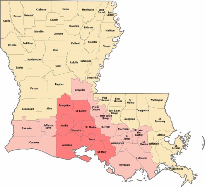
Our map shows Acadiana in south-central and southwestern Louisiana. It’s known for being the culturally distinct Cajun and Creole heartland.
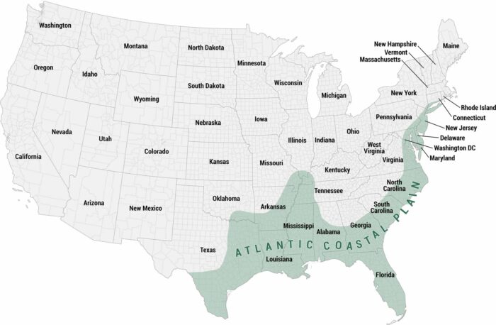
You’ll find the Atlantic Coastal Plain in our map of the United States. This region has low-lying terrain along the Atlantic Ocean.
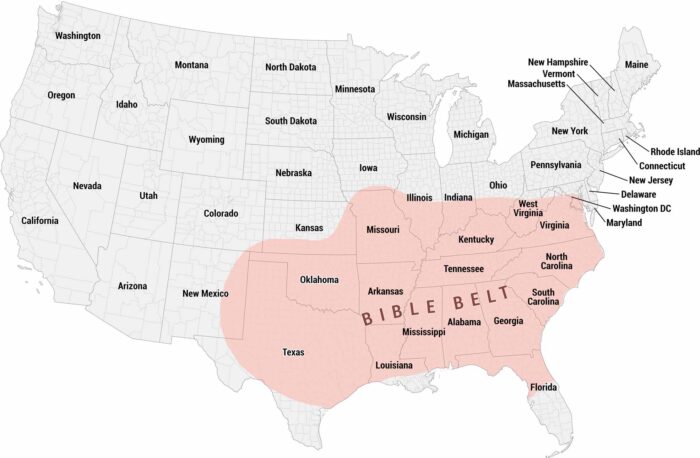
Our map shows the Bible Belt. This region of the American South and parts of the Midwest has historical high rates of church attendance.
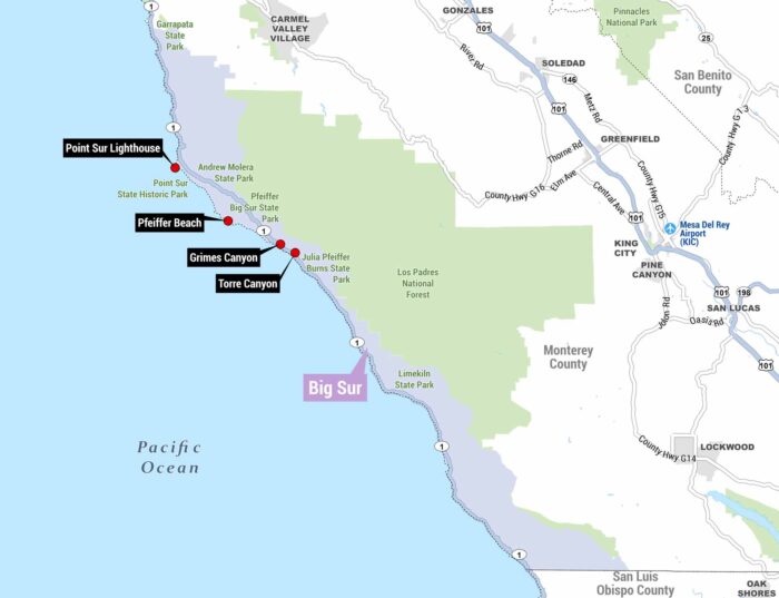
This is a detailed map of the Big Sur coastline in California. You’ll find the rugged stretch of CA-1 running along the Pacific Ocean.
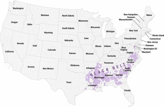
See the Black Belt region at the county level across the Deep South. It reflects the Black Belt’s geographic and demographic boundaries.
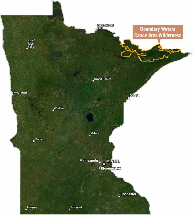
Here’s our satellite map of Minnesota highlighting the Boundary Waters Canoe Area Wilderness (BWCAW) outlined in orange.
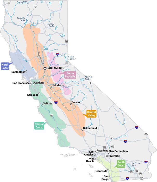
Our map of California displays its major wine-growing regions. It also includes major cities, highways, lakes, and rivers.
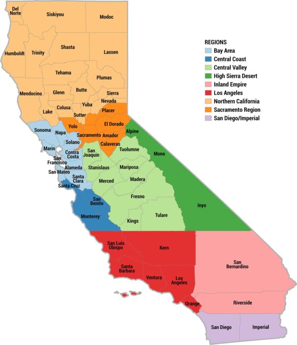
Our color-coded map divides California into 9 official regions. We’re showing each one with a distinct color as part of the legend.
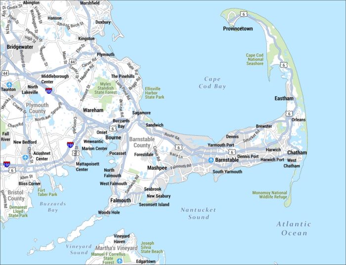
Check out our map of the Cape Cod region of Massachusetts. This area is known for its distinctive hook-shaped peninsula.
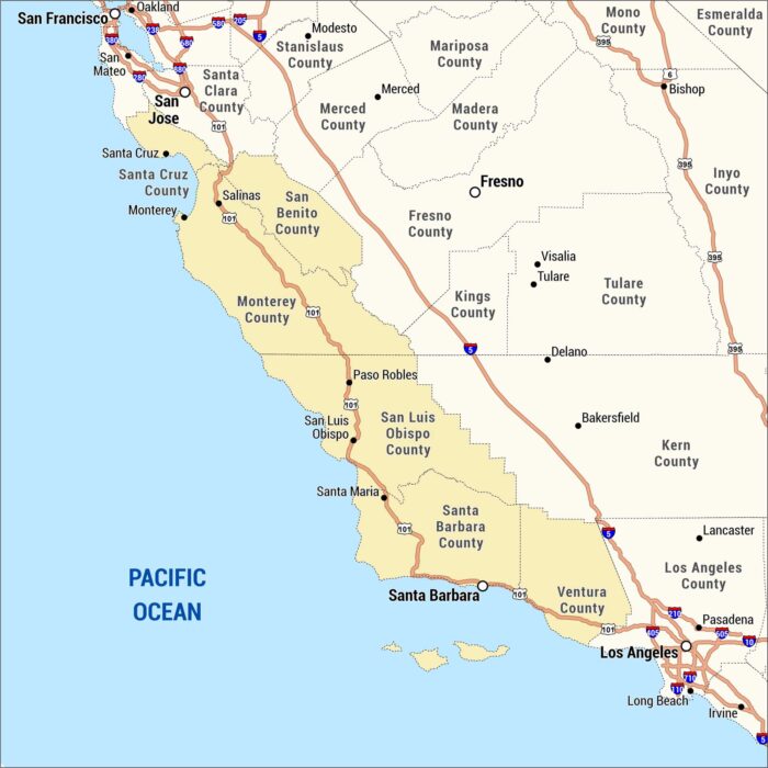
Check out our map of California’s Central Coast region, showing counties and cities. We’ve highlighted in gold along the Pacific coastline.
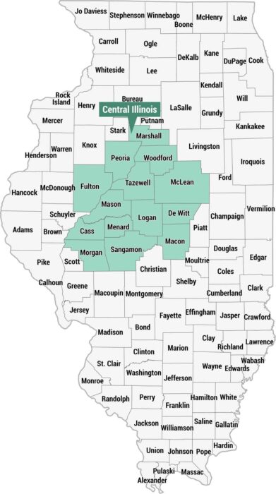
Here’s our county map highlighting the Central Illinois region in teal. You’ll find this region across the middle portion of the state.
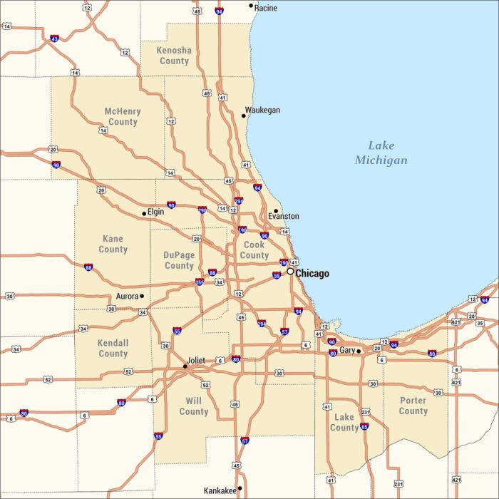
This is a detailed highway and county map of the Chicagoland region. Our map is centered on Chicago along southwestern Lake Michigan.
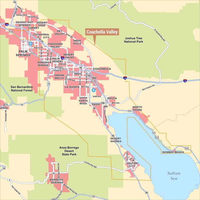
This is a detailed map of the Coachella Valley in southern California, with the valley boundary outlined in an orange dashed line.
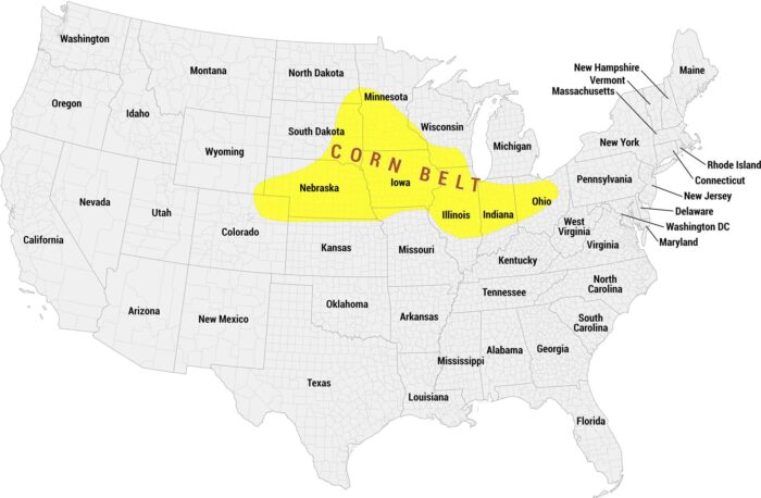
Our Corn Belt map shows this region in bright yellow across the upper Midwest. The area spans states, like Nebraska, Iowa, and Indiana.
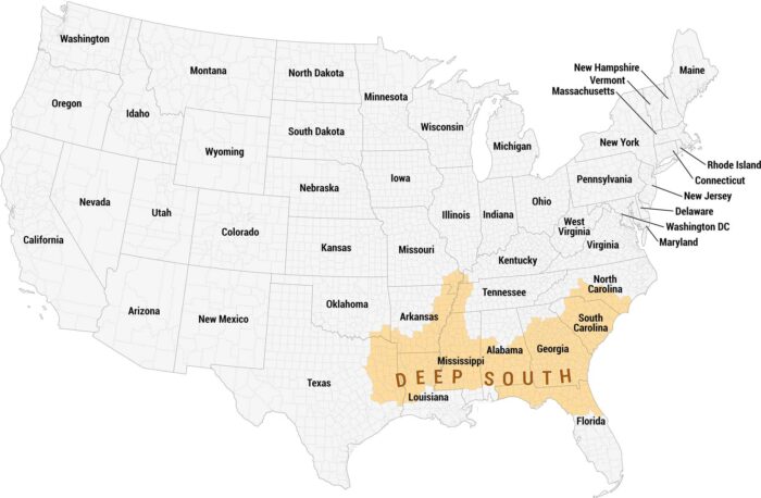
The Deep South dominates the southeastern portion of the United States. We’ve labeled the region on our map with an orange color.