Youghiogheny River Map
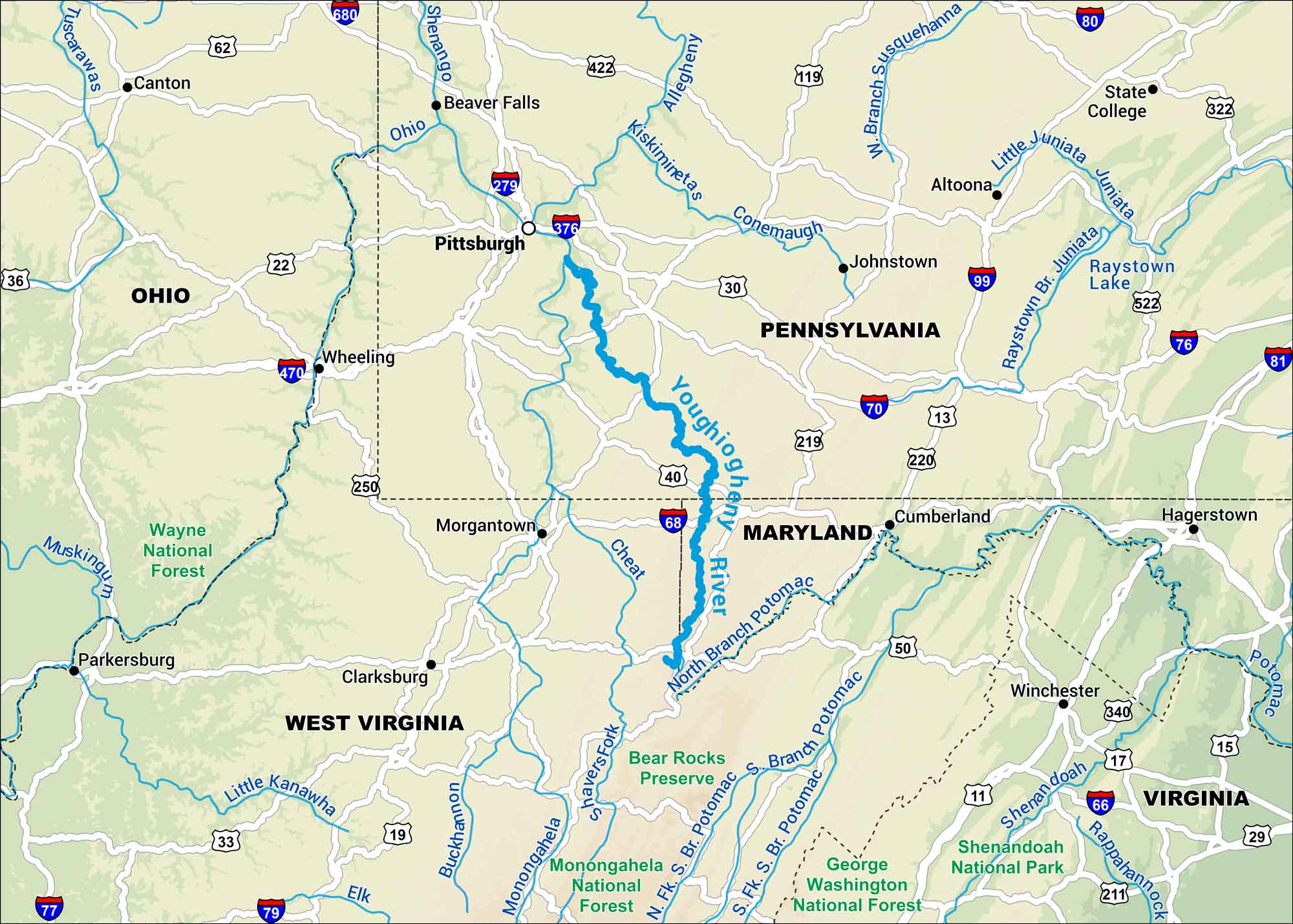
Our map of the Youghiogheny River follows its winding path through the Allegheny Mountains of southwestern Pennsylvania. It cuts through forested valleys and small towns. The water moves fast in spots, making it a favorite for whitewater runs.
Map Information
On the Map
Interstates: I-68, I-70, I-76, I-79, I-81 Major Highways: US Hwy 11, US Hwy 30, US Hwy 40, US Hwy 50, US Hwy 119, US Hwy 219, US Hwy 220, US Hwy 522 Rivers/Lakes: Youghiogheny River, Monongahela River, Allegheny River, Casselman River, Deep Creek Lake, Youghiogheny River Lake States: Pennsylvania, Maryland, West Virginia Cities/Towns: Pittsburgh, Morgantown, Cumberland, Uniontown, Connellsville
US Maps
Lakes and Rivers Map
Our map of America’s lakes and rivers shows the major waterways that define the country’s landscape.
Waterway Maps
Explore America’s waterways.


