Yellowstone River Map
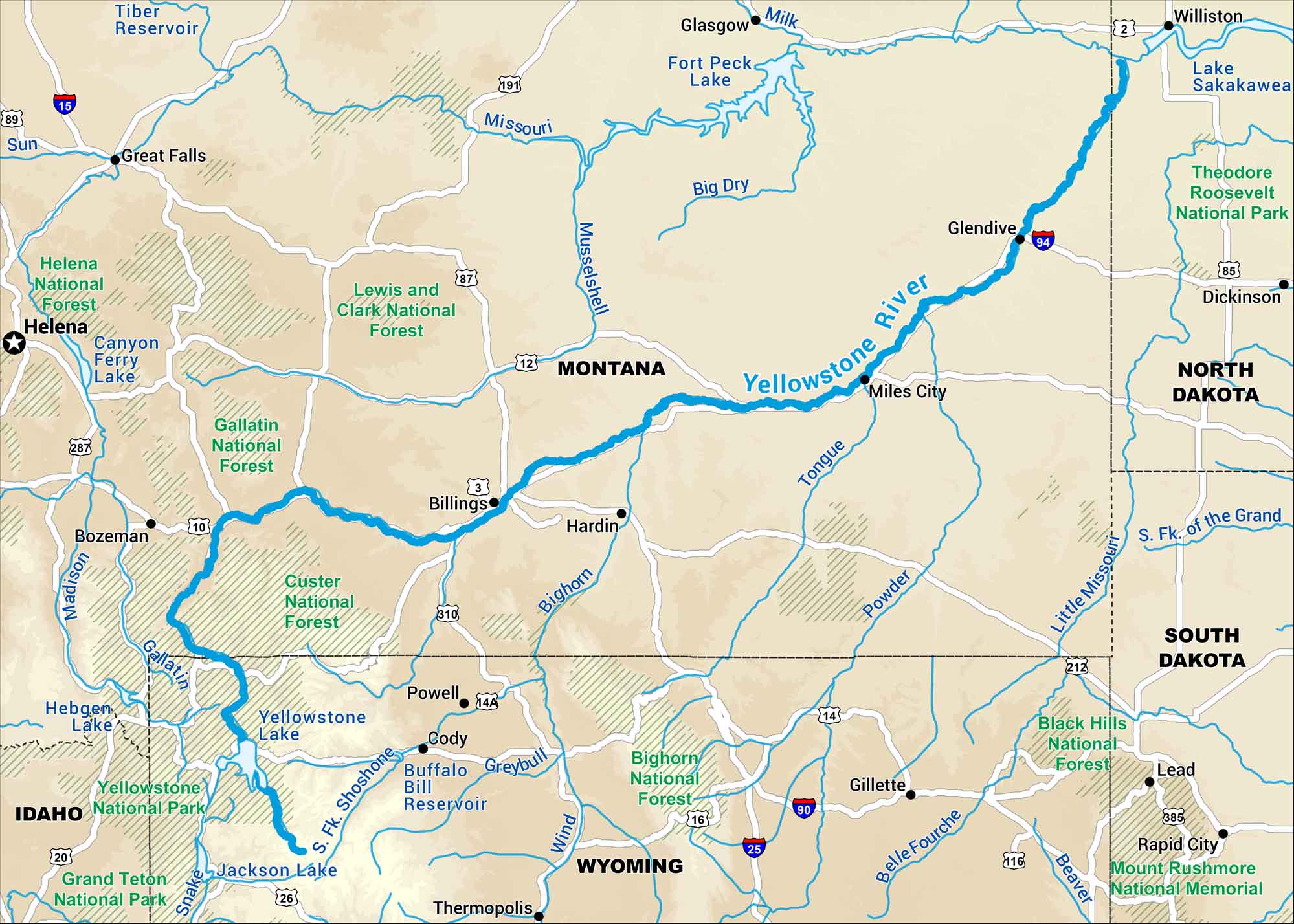
Here’s our map of the Yellowstone River running across southern Montana. It’s one of the last free-flowing rivers in the West, stretching from Yellowstone National Park through wide open plains. Along the way, it passes cities like Billings, Glendive and Miles City.
Map Information
On the Map
Interstates: I-90, I-94 Major Highways: US Hwy 10, US Hwy 12, US Hwy 14, US Hwy 16, US Hwy 20, US Hwy 87, US Hwy 89, US Hwy 191, US Hwy 212, US Hwy 287, US Hwy 310 Rivers/Lakes: Yellowstone River, Missouri River, Bighorn River, Tongue River, Powder River, Stillwater River, Clarks Fork Yellowstone River, Shoshone River, Wind River, Yellowstone Lake, Bighorn Lake, Boysen Reservoir National Forests and Parks: Yellowstone National Park, Grand Teton National Park, Custer National Forest, Gallatin National Forest, Shoshone National Forest, Bridger-Teton National Forest States: Montana, Wyoming, North Dakota Cities/Towns: Billings, Bozeman, Livingston, Miles City, Glendive, Cody, Riverton
US Maps
Lakes and Rivers Map
Our map of America’s lakes and rivers shows the major waterways that define the country’s landscape.
Waterway Maps
Explore America’s waterways.


