Wind River Map
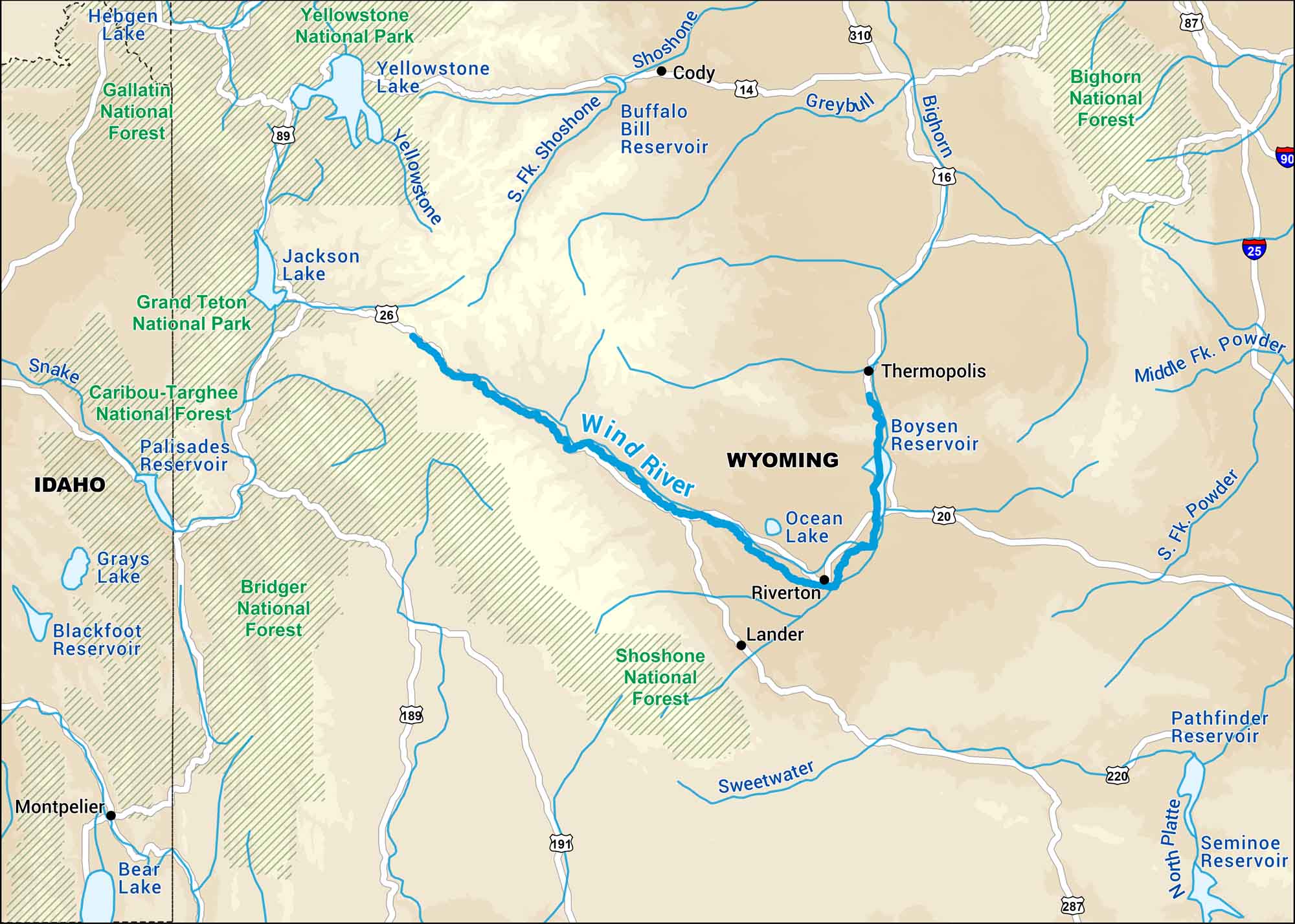
Our Wind River map highlights its run through the mountains of western Wyoming. Its upper stretches cut through some of the most scenic country in the Rockies.
Map Information
On the Map
Major Highways: US Hwy 20, US Hwy 26, US Hwy 191, US Hwy 287 Rivers/Lakes: Wind River, Bighorn River, Little Wind River, Popo Agie River, Sweetwater River, Boysen Reservoir, Bull Lake, Pilot Butte Reservoir National Forests and Parks: Yellowstone National Park, Grand Teton National Park, Bridger-Teton National Forest, Shoshone National Forest States: Wyoming Cities/Towns: Riverton, Lander, Dubois
US Maps
Lakes and Rivers Map
Our map of America’s lakes and rivers shows the major waterways that define the country’s landscape.
Waterway Maps
Explore America’s waterways.


