Willamette River Map
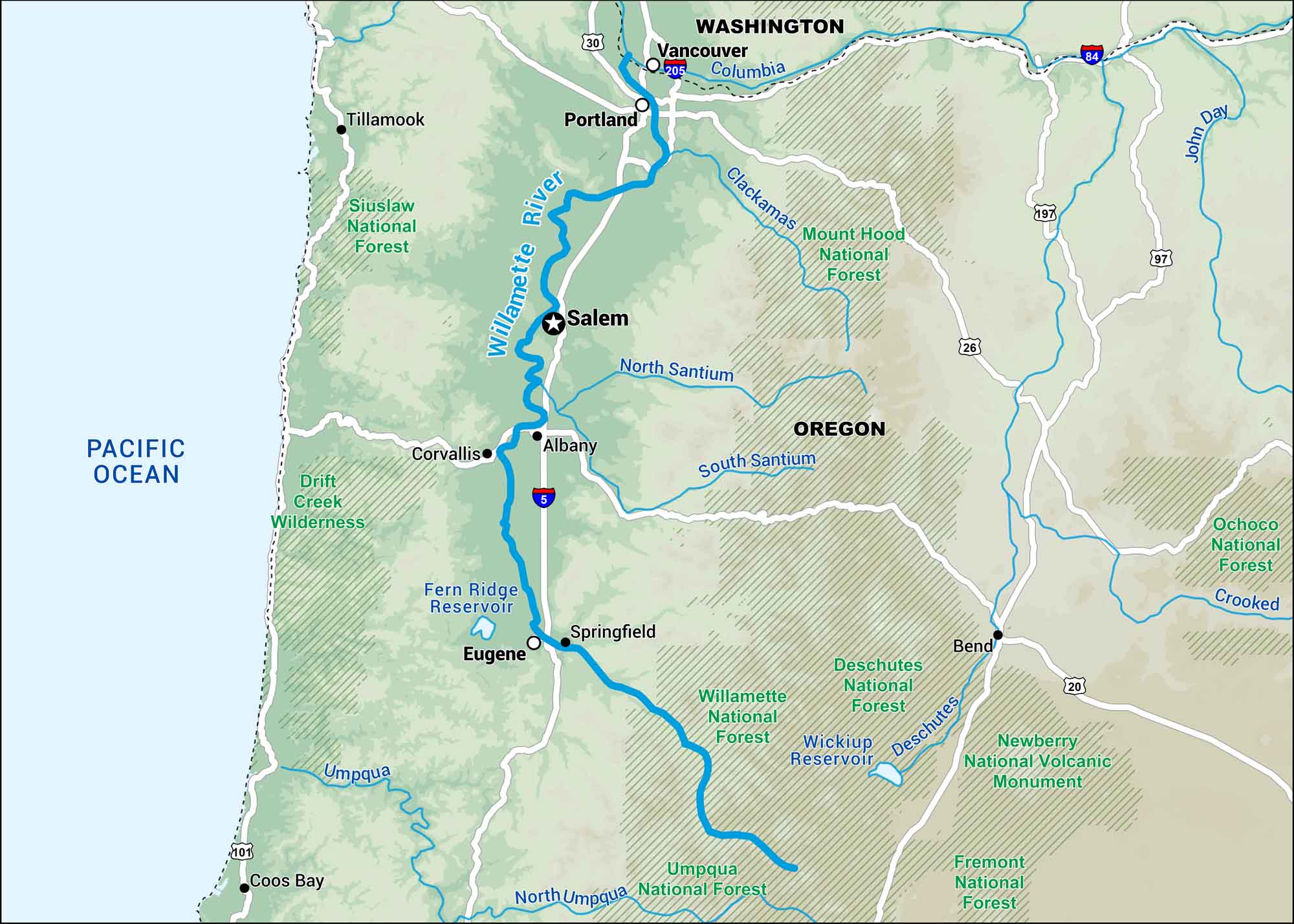
Here’s our map of the Willamette River flowing through western Oregon. It runs past Eugene, Salem, and Portland, connecting farmland, forests, and cities along its banks. Bridges, parks, and trails line the water through nearly every town.
Map Information
On the Map
Interstates: I-5, I-84, I-205, I-405 Major Highways: US Hwy 20, US Hwy 26, US Hwy 30, US Hwy 101, US Hwy 126 Rivers/Lakes: Willamette River, Columbia River, McKenzie River, Santiam River, Coast Fork Willamette River, Middle Fork Willamette River, Fern Ridge Lake, Detroit Lake, Cougar Reservoir, Lookout Point Lake, Hills Creek Lake, Pacific Ocean National Forests: Mount Hood National Forest, Willamette National Forest, Siuslaw National Forest, Umpqua National Forest States: Oregon, Washington Cities/Towns: Portland, Salem, Eugene, Hillsboro, Beaverton, Gresham, Vancouver, Corvallis, Albany, Springfield
US Maps
Lakes and Rivers Map
Our map of America’s lakes and rivers shows the major waterways that define the country’s landscape.
Waterway Maps
Explore America’s waterways.


