Tennessee River Map
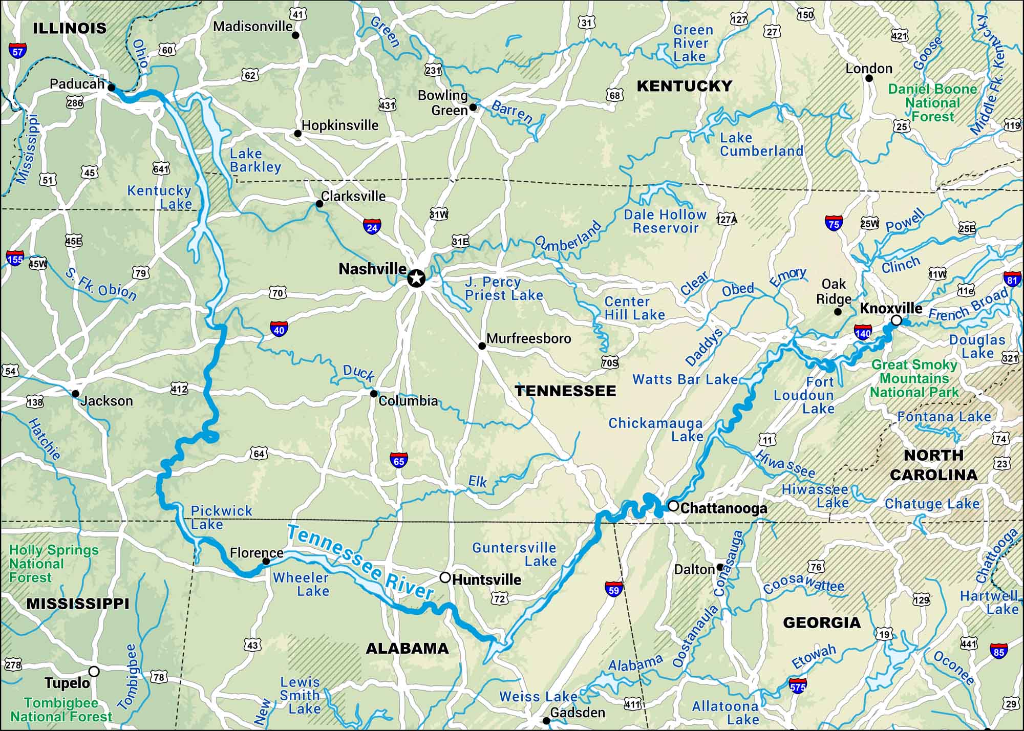
Our map displays the Tennessee River, which runs through Alabama and Tennessee. It cuts through cities like Chattanooga, Knoxville and, places built around its bends.
Map Information
On the Map
Interstates: I-20, I-24, I-40, I-59, I-65, I-75, I-81 Major Highways: US Hwy 11, US Hwy 23, US Hwy 25, US Hwy 27, US Hwy 31, US Hwy 41, US Hwy 43, US Hwy 45, US Hwy 51, US Hwy 64, US Hwy 70, US Hwy 72, US Hwy 74, US Hwy 76, US Hwy 78, US Hwy 79, US Hwy 127, US Hwy 231, US Hwy 411, US Hwy 431 Rivers/Lakes: Tennessee River, Ohio River, Cumberland River, Mississippi River, Duck River, Elk River, Clinch River, Holston River, French Broad River, Hiwassee River, Kentucky Lake, Lake Barkley, Pickwick Lake, Wheeler Lake, Guntersville Lake, Nickajack Lake, Chickamauga Lake, Watts Bar Lake, Fort Loudoun Lake National Forests and Parks: Great Smoky Mountains National Park, Cherokee National Forest, Daniel Boone National Forest, Nantahala National Forest, Pisgah National Forest, William B. Bankhead National Forest States: Tennessee, Alabama, Kentucky, Mississippi, Georgia, North Carolina, Virginia Cities/Towns: Nashville, Memphis, Knoxville, Chattanooga, Huntsville, Birmingham, Decatur, Florence, Paducah, Asheville
US Maps
Lakes and Rivers Map
Our map of America’s lakes and rivers shows the major waterways that define the country’s landscape.
Waterway Maps
Explore America’s waterways.


