Susquehanna River Map
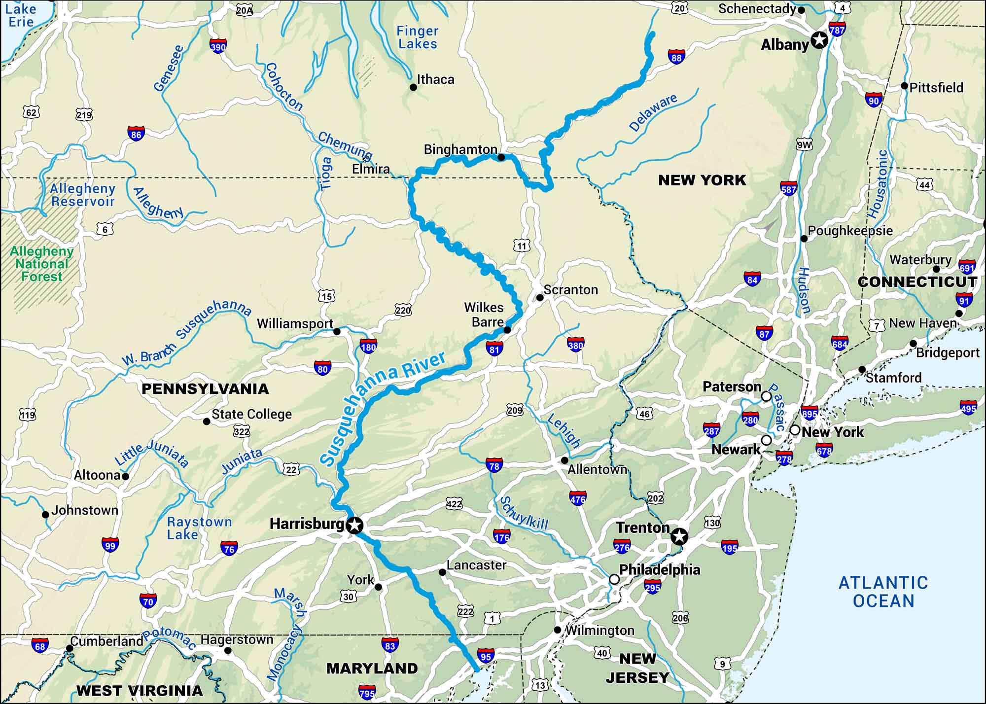
Our map shows the Susquehanna River all the way from New York down to the Chesapeake Bay. It’s a long river with industrial towns, quiet farmland, and bridges crossing wide water. It’s part of the backbone of the Northeast.
Map Information
On the Map
Interstates: I-70, I-76, I-78, I-80, I-81, I-83, I-84, I-86, I-88, I-95, I-99, I-180 Major Highways: US Hwy 6, US Hwy 11, US Hwy 15, US Hwy 20, US Hwy 22, US Hwy 30, US Hwy 119, US Hwy 202, US Hwy 219, US Hwy 220, US Hwy 222, US Hwy 322, US Hwy 422, US Hwy 522 Rivers/Lakes: Susquehanna River, Juniata River, West Branch Susquehanna River, Chemung River, Delaware River, Potomac River, Allegheny River, Genesee River, Finger Lakes, Chesapeake Bay States: New York, Pennsylvania, Maryland Cities/Towns: Harrisburg, Scranton, Wilkes-Barre, Binghamton, Lancaster, York, State College, Williamsport, Elmira, Corning, Oneonta, Cooperstown
US Maps
Lakes and Rivers Map
Our map of America’s lakes and rivers shows the major waterways that define the country’s landscape.
Waterway Maps
Explore America’s waterways.


