Snake River Map
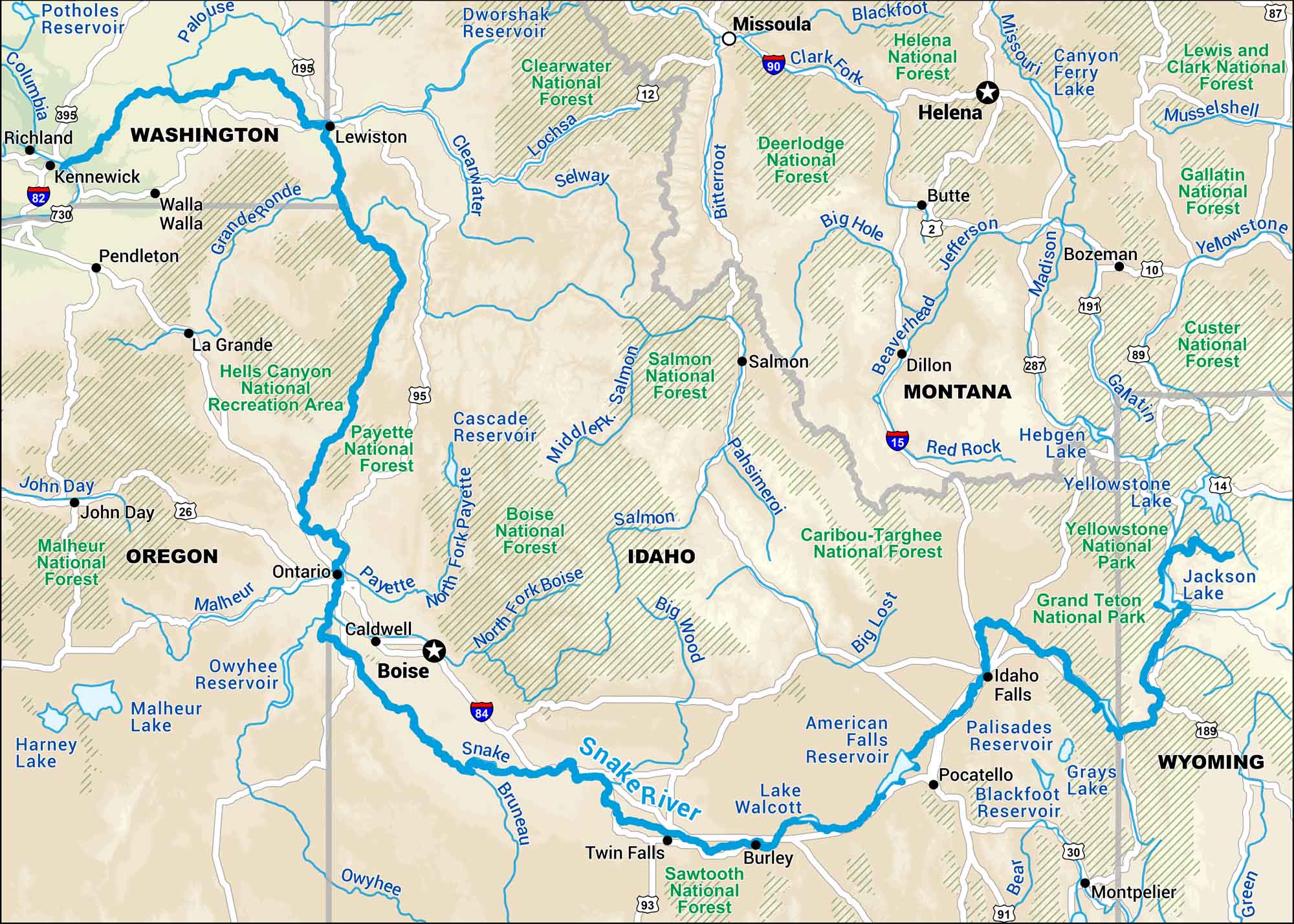
Our map of the Snake River stretches across southern Idaho and beyond. You can follow it for miles and the scenery keeps changing in farmland, desert cliffs, and wide open country.
Map Information
On the Map
Interstates: I-15, I-82, I-84, I-90 Major Highways: US Hwy 2, US Hwy 10, US Hwy 12, US Hwy 14, US Hwy 20, US Hwy 26, US Hwy 30, US Hwy 87, US Hwy 89, US Hwy 91, US Hwy 93, US Hwy 95, US Hwy 189, US Hwy 191, US Hwy 195, US Hwy 287, US Hwy 395, US Hwy 730 Rivers/Lakes: Snake River, Clearwater River, Salmon River, Lochsa River, Selway River, Clark Fork River, Bitterroot River, Blackfoot River, Missouri River, Musselshell River, Yellowstone River, Madison River, Jefferson River, Beaverhead River, Big Hole River, Pahsimeroi River, Big Lost River, Big Wood River, Boise River, Payette River, Owyhee River, Malheur River, John Day River, Grande Ronde River, Palouse River, Bruneau River, Bear River, Green River, Lake Walcott, American Falls Reservoir, Palisades Reservoir, Blackfoot River Reservoir, Grays Lake, Jackson Lake, Yellowstone Lake, Hebgen Lake, Canyon Ferry Lake, Dworshak Reservoir, Cascade Reservoir, Owyhee Reservoir, Malheur Lake, Harney Lake, Potholes Reservoir National Forests and Parks: Grand Teton National Park, Yellowstone National Park, Clearwater National Forest, Helena National Forest, Lewis and Clark National Forest, Gallatin National Forest, Custer National Forest, Caribou-Targhee National Forest, Sawtooth National Forest, Boise National Forest, Salmon National Forest, Payette National Forest, Malheur National Forest, Deerlodge National Forest, Hells Canyon National Recreation Area States: Idaho, Wyoming, Montana, Oregon, Washington Cities/Towns: Boise, Helena, Missoula, Idaho Falls, Pocatello, Twin Falls, Richland, Kennewick, Lewiston, Walla Walla, Pendleton, La Grande, Ontario, Caldwell, Salmon, Dillon, Butte, Bozeman, Burley, Montpelier
US Maps
Lakes and Rivers Map
Our map of America’s lakes and rivers shows the major waterways that define the country’s landscape.
Waterway Maps
Explore America’s waterways.


