Skagit River Map
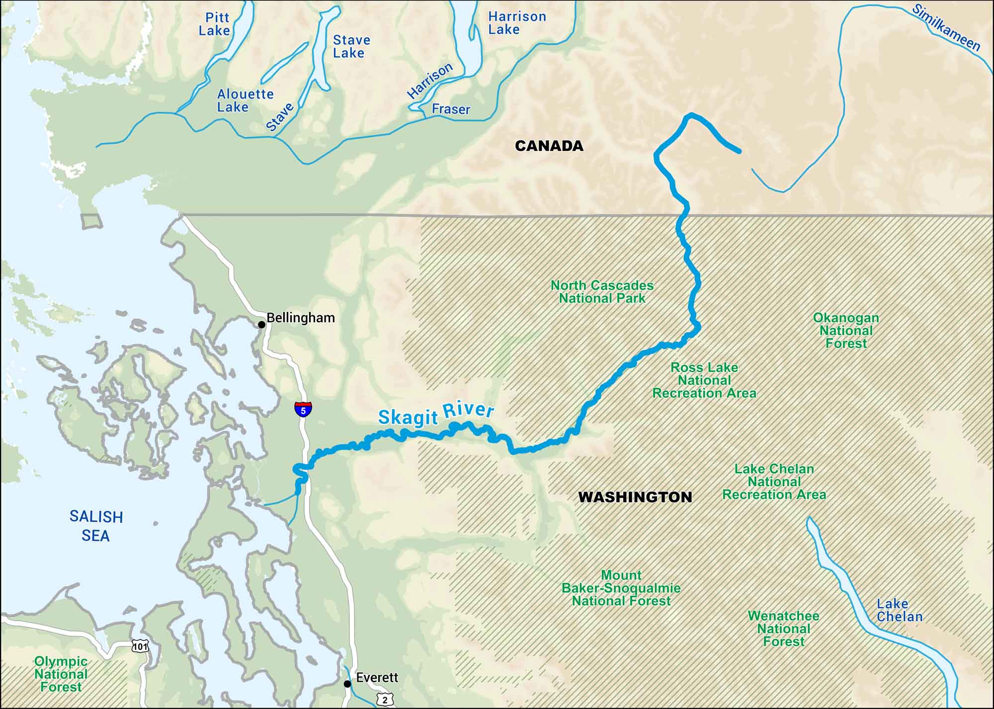
The Skagit River runs from the Cascades down toward Puget Sound. Locals know it for the salmon runs and the way it floods in the spring. Our map follows every curve as it cuts through farmland and mountain country before hitting the lowlands.
Map Information
On the Map
Interstates: I-5 Major Highways: US Hwy 2, US Hwy 101 Rivers/Lakes: Skagit River, Fraser River, Harrison River, Stave River, Similkameen River, Salish Sea, Lake Chelan, Ross Lake, Stave Lake, Alouette Lake, Pitt Lake, Harrison Lake National Forests and Parks: North Cascades National Park, Ross Lake National Recreation Area, Lake Chelan National Recreation Area, Okanogan National Forest, Wenatchee National Forest, Mount Baker-Snoqualmie National Forest, Olympic National Forest States: Washington Cities/Towns: Bellingham, Everett Countries: Canada
US Maps
Lakes and Rivers Map
Our map of America’s lakes and rivers shows the major waterways that define the country’s landscape.
Waterway Maps
Explore America’s waterways.


