Schuylkill River Map
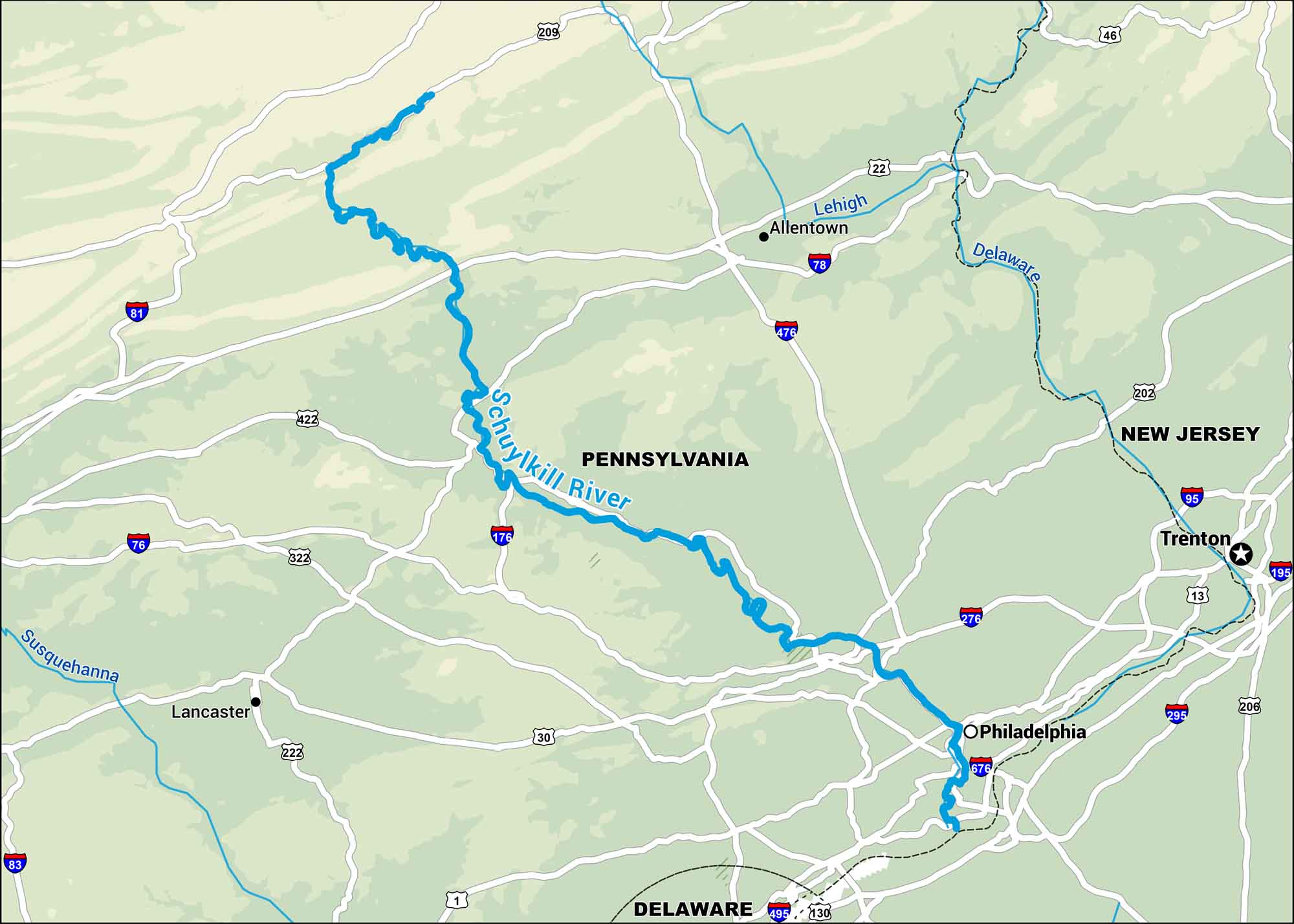
Our map of the Schuylkill River runs right through the heart of southeastern Pennsylvania, cutting across small towns and into Philadelphia. You’ll see old industrial sites that now feel like part of the city’s history.
Map Information
On the Map
Interstates: I-76, I-78, I-81, I-83, I-95, I-176, I-195, I-276, I-295, I-476, I-495, I-676 Major Highways: US Hwy 1, US Hwy 13, US Hwy 22, US Hwy 30, US Hwy 46, US Hwy 130, US Hwy 202, US Hwy 206, US Hwy 209, US Hwy 222, US Hwy 322, US Hwy 422 Major Rivers: Schuylkill River, Lehigh River, Delaware River, Susquehanna River States: Pennsylvania, New Jersey, Delaware Cities/Towns: Philadelphia, Allentown, Trenton, Lancaster
US Maps
Lakes and Rivers Map
Our map of America’s lakes and rivers shows the major waterways that define the country’s landscape.
Waterway Maps
Explore America’s waterways.


