San Juan River Map
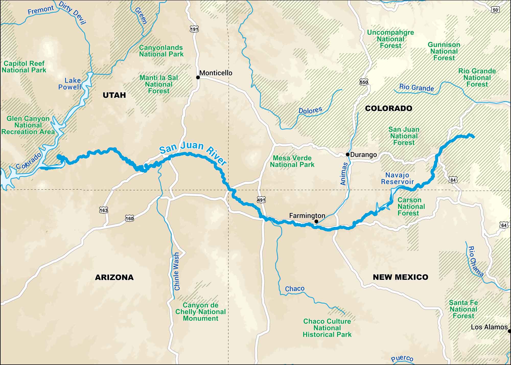
Our map of the San Juan River runs through the red rock country of New Mexico and Utah. It’s a rugged, remote stretch. Eventually, it connects with the Colorado River deep in the desert.
Map Information
On the Map
Major Highways: US Hwy 50, US Hwy 64, US Hwy 84, US Hwy 160, US Hwy 163, US Hwy 191, US Hwy 491, US Hwy 550 Rivers/Lakes: San Juan River, Colorado River, Green River, Dirty Devil River, Fremont River, Dolores River, Animas River, Rio Grande River, Rio Chama River, Puerco River, Chaco River, Chinle Wash, Lake Powell, Navajo Reservoir National Forests and Parks: Canyonlands National Park, Capitol Reef National Park, Mesa Verde National Park, Glen Canyon National Recreation Area, Manti-La Sal National Forest, Uncompahgre National Forest, Gunnison National Forest, Rio Grande National Forest, San Juan National Forest, Carson National Forest, Santa Fe National Forest States: Utah, Colorado, Arizona, New Mexico Cities/Towns: Farmington, Durango, Monticello, Los Alamos Major Landmarks: Canyon de Chelly National Monument, Chaco Culture National Historical Park
US Maps
Lakes and Rivers Map
Our map of America’s lakes and rivers shows the major waterways that define the country’s landscape.
Waterway Maps
Explore America’s waterways.


