Salt River Map
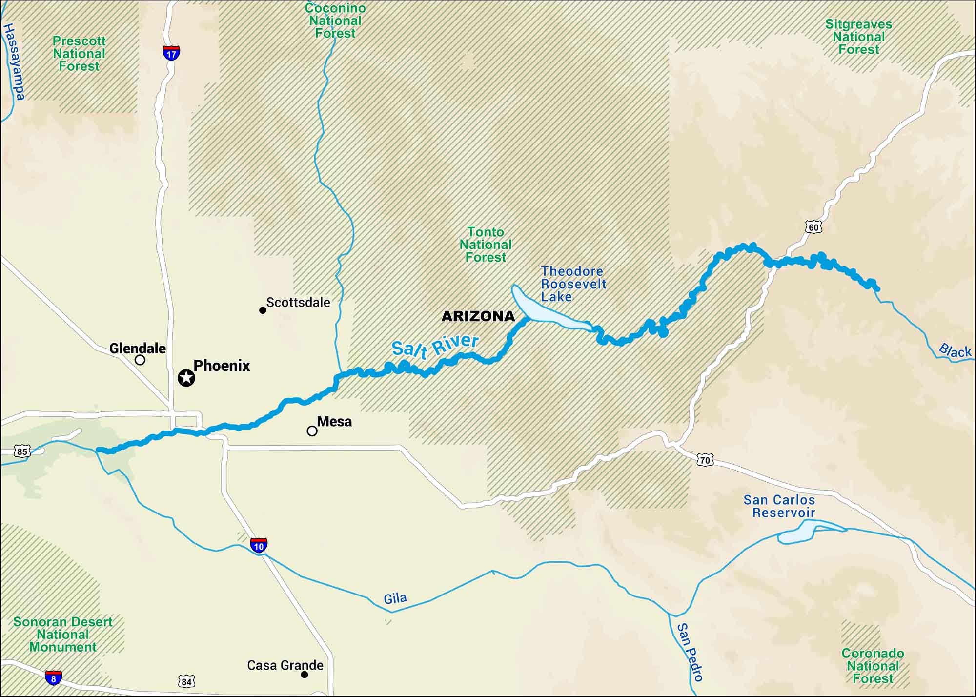
This map highlights the Salt River in central Arizona, where desert cliffs and reservoirs define its course. It’s a key water source for Phoenix and a favorite spot for recreation.
Map Information
On the Map
Interstates: I-8, I-10, I-17, I-84 Major Highways: US Hwy 60, US Hwy 70, US Hwy 85 Rivers/Reservoirs: Salt River, Gila River, San Pedro River, Black River, Hassayampa River, Theodore Roosevelt Lake, San Carlos Reservoir National Forests and Monuments: Tonto National Forest, Coconino National Forest, Sitgreaves National Forest, Coronado National Forest, Sonoran Desert National Monument, Prescott National Forest States: Arizona Cities/Towns: Phoenix, Scottsdale, Mesa, Glendale, Casa Grande
US Maps
Lakes and Rivers Map
Our map of America’s lakes and rivers shows the major waterways that define the country’s landscape.
Waterway Maps
Explore America’s waterways.


