Sabine River Map
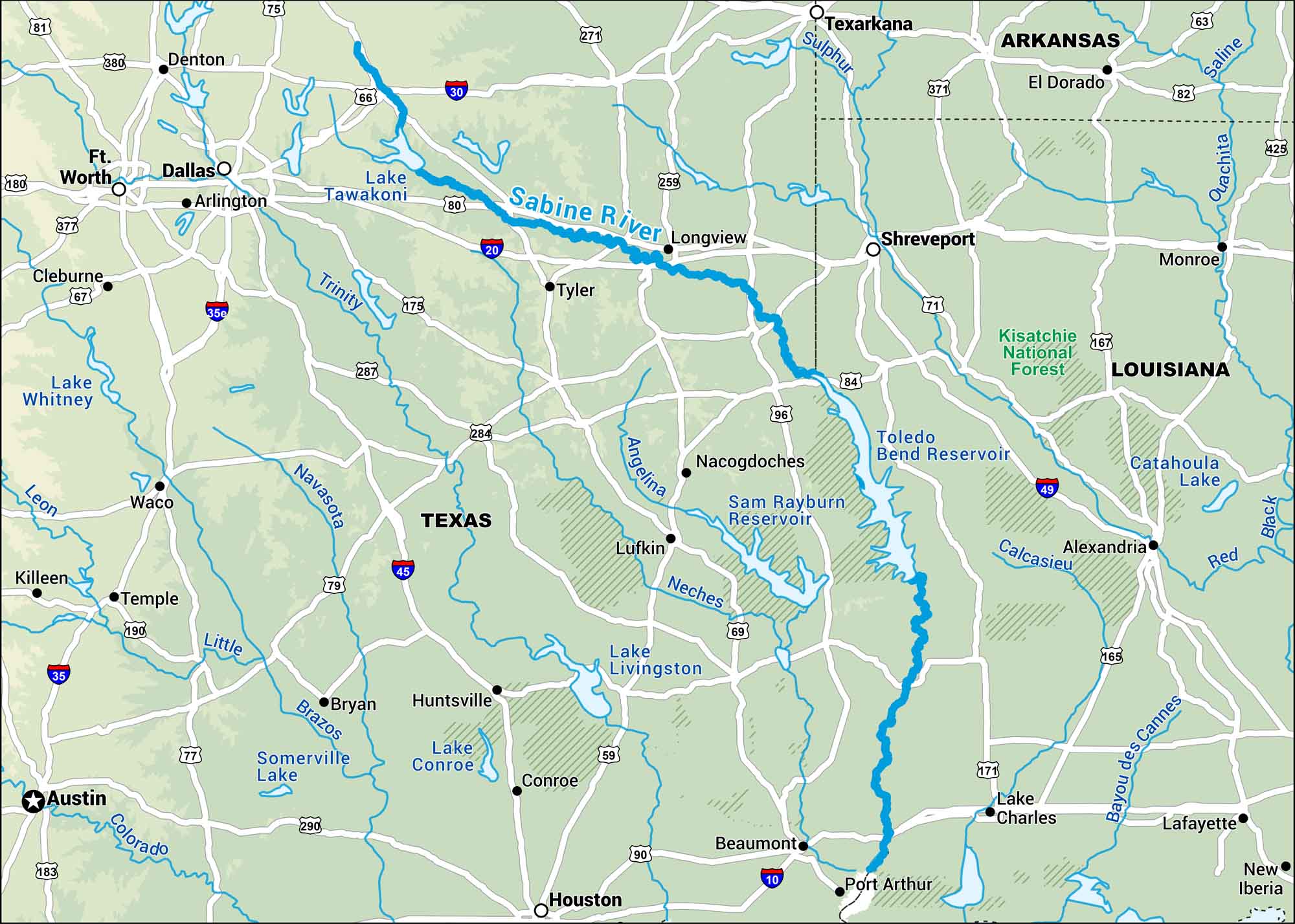
Our map of the Sabine River shows where it separates Texas from Louisiana as it flows down towards the Gulf. It winds through the Lake Tawakoni and Toledo Bend Reservoir.
Map Information
On the Map
Interstates: I-10, I-20, I-30, I-35, I-45, I-49 Major Highways: US Hwy 59, US Hwy 63, US Hwy 67, US Hwy 69, US Hwy 71, US Hwy 75, US Hwy 77, US Hwy 79, US Hwy 80, US Hwy 81, US Hwy 82, US Hwy 84, US Hwy 87, US Hwy 90, US Hwy 96, US Hwy 165, US Hwy 167, US Hwy 171, US Hwy 175, US Hwy 180 Rivers/Lakes: Sabine River, Trinity River, Navasota River, Angelina River, Neches River, Little River, Brazos River, Colorado River, Sulphur River, Saline River, Ouachita River, Red River, Lake Tawakoni, Lake Whitney, Sam Rayburn Reservoir, Toledo Bend Reservoir, Lake Livingston, Somerville Lake, Lake Conroe, Catahoula Lake National Forests: Kisatchie National Forest States: Texas, Louisiana, Arkansas Cities/Towns: Houston, Dallas, Fort Worth, Austin, Shreveport, Arlington, Tyler, Longview, Beaumont, Port Arthur, Lake Charles, Alexandria, Texarkana, Monroe, El Dorado, Lufkin, Nacogdoches, Waco, Temple, Bryan
US Maps
Lakes and Rivers Map
Our map of America’s lakes and rivers shows the major waterways that define the country’s landscape.
Waterway Maps
Explore America’s waterways.


