Rogue River Map
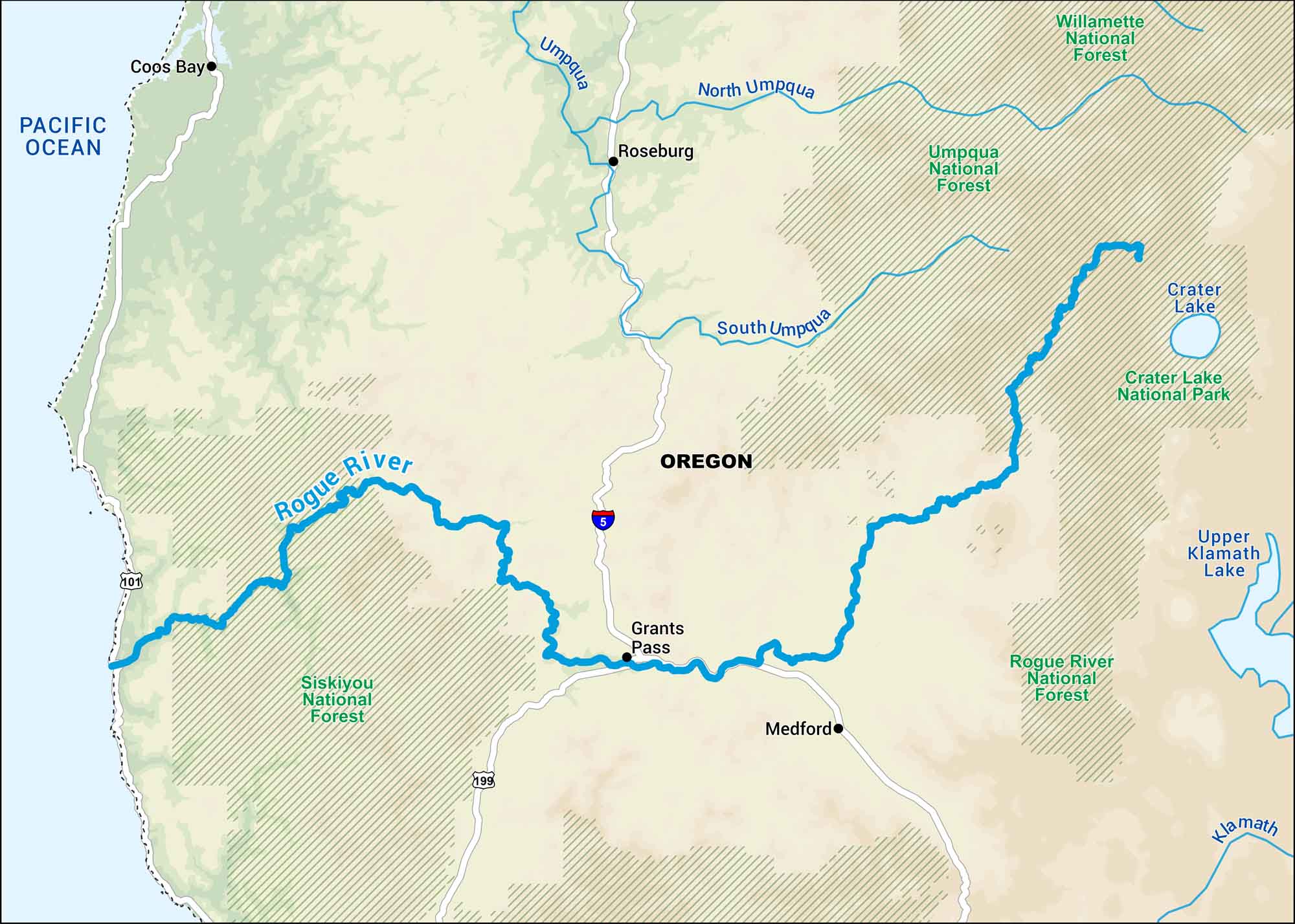
Our map of the Rogue River runs through southern Oregon’s forests and rugged canyons. It’s one of the state’s best-known rivers for rafting and salmon fishing.
Map Information
On the Map
Interstates: I-5 Major Highways: US Hwy 101, US Hwy 199 Water Bodies: Rogue River, Umpqua River, North Umpqua River, South Umpqua River, Klamath River, Crater Lake, Upper Klamath Lake, Pacific Ocean National Forests and Parks: Willamette National Forest, Umpqua National Forest, Crater Lake National Park, Rogue River National Forest, Siskiyou National Forest States: Oregon Cities/Towns: Coos Bay, Roseburg, Grants Pass, Medford
US Maps
Lakes and Rivers Map
Our map of America’s lakes and rivers shows the major waterways that define the country’s landscape.
Waterway Maps
Explore America’s waterways.


