Rock River Map
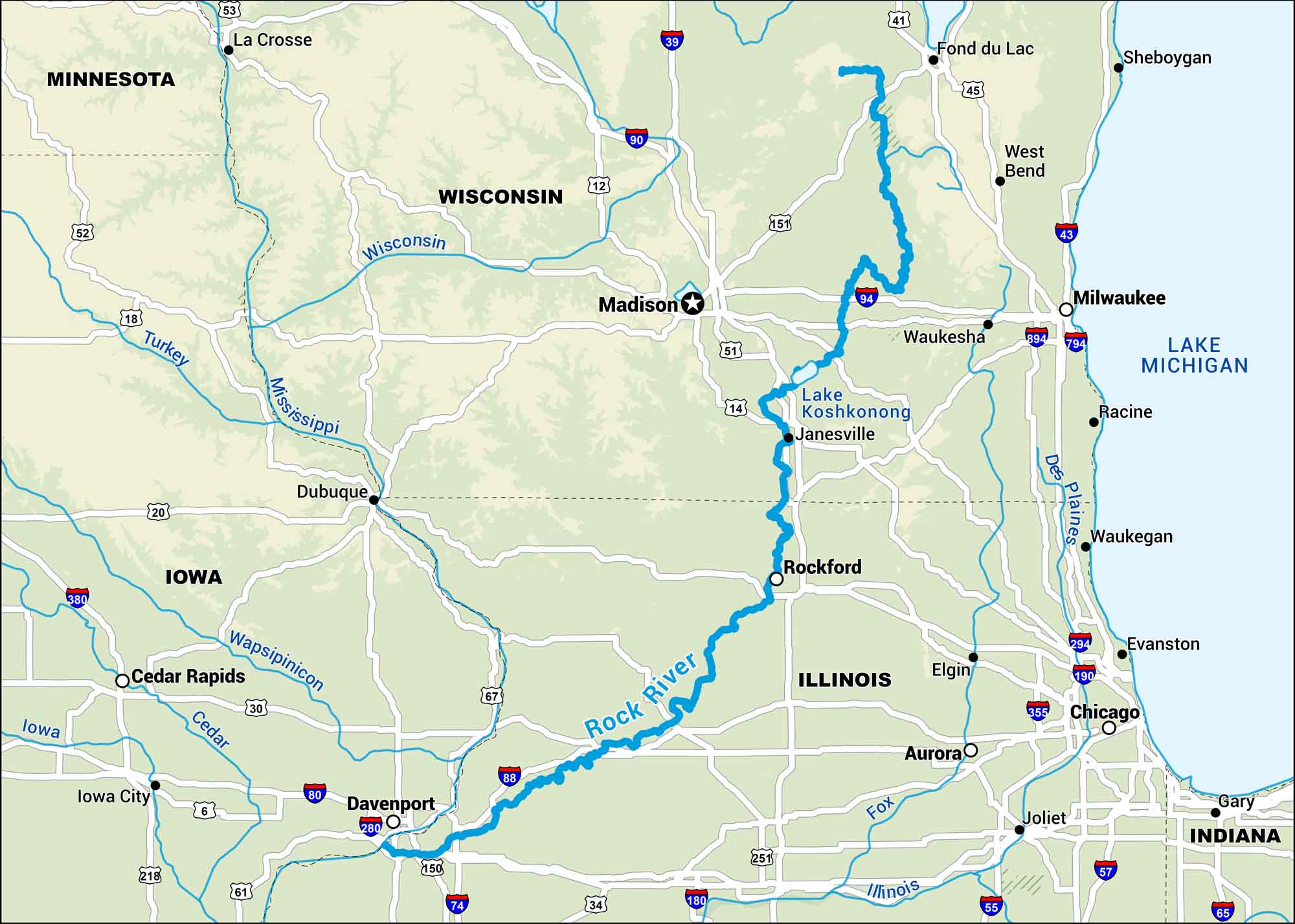
The Rock River flows through Wisconsin and Illinois, and our map shows its steady path toward the Mississippi. It passes old mill towns and stretches of farmland.
Map Information
On the Map
Interstates: I-39, I-41, I-43, I-55, I-57, I-65, I-74, I-80, I-88, I-90, I-94, I-180, I-190, I-280, I-294, I-355, I-380, I-394, I-794, I-894 Major Highways: US Hwy 6, US Hwy 12, US Hwy 14, US Hwy 18, US Hwy 20, US Hwy 30, US Hwy 34, US Hwy 45, US Hwy 51, US Hwy 52, US Hwy 53, US Hwy 61, US Hwy 67, US Hwy 151, US Hwy 251 Rivers/Lakes: Rock River, Wisconsin River, Mississippi River, Turkey River, Wapsipinicon River, Cedar River, Iowa River, Fox River, Illinois River, Des Plaines River, Lake Koshkonong, Lake Michigan States: Minnesota, Wisconsin, Iowa, Illinois, Indiana Cities/Towns: La Crosse, Madison, Janesville, Rockford, Davenport, Cedar Rapids, Iowa City, Dubuque, Waukesha, Milwaukee, Racine, Waukegan, Evanston, Chicago, Gary, Joliet, Aurora, Elgin, Fond du Lac, West Bend, Sheboygan
US Maps
Lakes and Rivers Map
Our map of America’s lakes and rivers shows the major waterways that define the country’s landscape.
Waterway Maps
Explore America’s waterways.


