Rio Grande Map
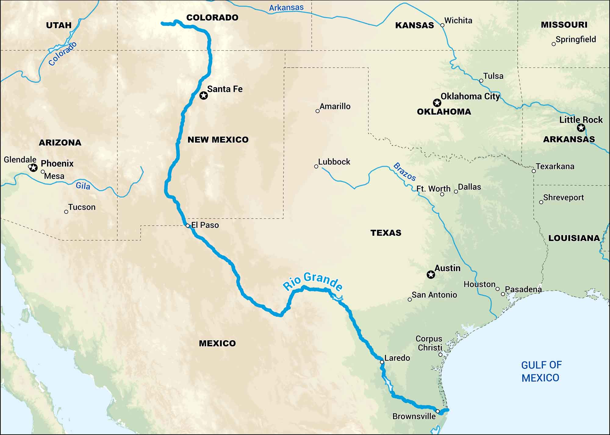
Our map of the Rio Grande follows its long journey from the mountains of Colorado down along the Texas-Mexico border. It’s both a natural landmark and something special for desert communities.
Map Information
On the Map
Major Highways: US Hwy 10 Major Rivers: Rio Grande River, Colorado River, Gila River, Brazos River, Arkansas River States: Utah, Colorado, Arizona, New Mexico, Texas, Kansas, Oklahoma, Missouri, Arkansas, Louisiana Cities/Towns: Santa Fe, El Paso, Laredo, Brownsville, Corpus Christi, San Antonio, Austin, Houston, Pasadena, Amarillo, Lubbock, Ft. Worth, Dallas, Oklahoma City, Tulsa, Wichita, Springfield, Little Rock, Texarkana, Shreveport Countries: Mexico
US Maps
Lakes and Rivers Map
Our map of America’s lakes and rivers shows the major waterways that define the country’s landscape.
Waterway Maps
Explore America’s waterways.


