Red River Map
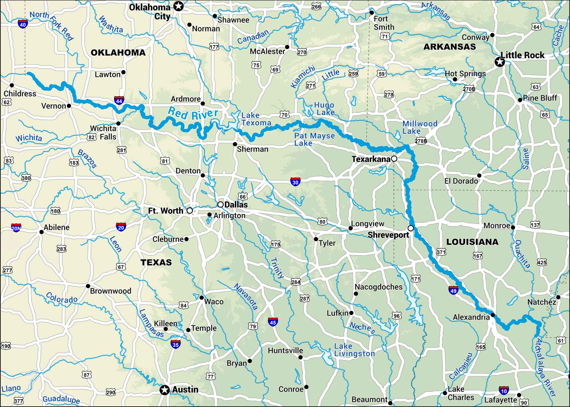
This map shows the Red River stretching between Texas and Oklahoma before turning through Louisiana. Its muddy waters and wide bends mark centuries of Southern history.
Map Information
On the Map
Interstates: I-20, I-30, I-35, I-40, I-44, I-49 Major Highways: US Hwy 59, US Hwy 62, US Hwy 67, US Hwy 69, US Hwy 70, US Hwy 71, US Hwy 75, US Hwy 77, US Hwy 80, US Hwy 81, US Hwy 82, US Hwy 83, US Hwy 84, US Hwy 165, US Hwy 171, US Hwy 175, US Hwy 177, US Hwy 180, US Hwy 183, US Hwy 190 Waterbodies: North Fork Red River, Washita River, Red River, Wichita River, Brazos River, Colorado River, Leon River, Trinity River, Neches River, Canadian River, Little River, Arkansas River, Saline River, Ouachita River, Cache River, Lake Texoma, Hugo Lake, Pat Mayse Lake, Millwood Lake, Lake Livingston States: Oklahoma, Texas, Arkansas, Louisiana Cities/Towns: Childress, Vernon, Wichita Falls, Lawton, Ardmore, Oklahoma City, Norman, Shawnee, McAlester, Sherman, Denton, Ft. Worth, Arlington, Dallas, Cleburne, Waco, Temple, Bryan, Austin, Tyler, Longview, Shreveport, Nacogdoches, Lufkin, Alexandria, Natchez, Lake Charles, Lafayette, Beaumont, Conroe
US Maps
Lakes and Rivers Map
Our map of America’s lakes and rivers shows the major waterways that define the country’s landscape.
Waterway Maps
Explore America’s waterways.


