Potomac River Map
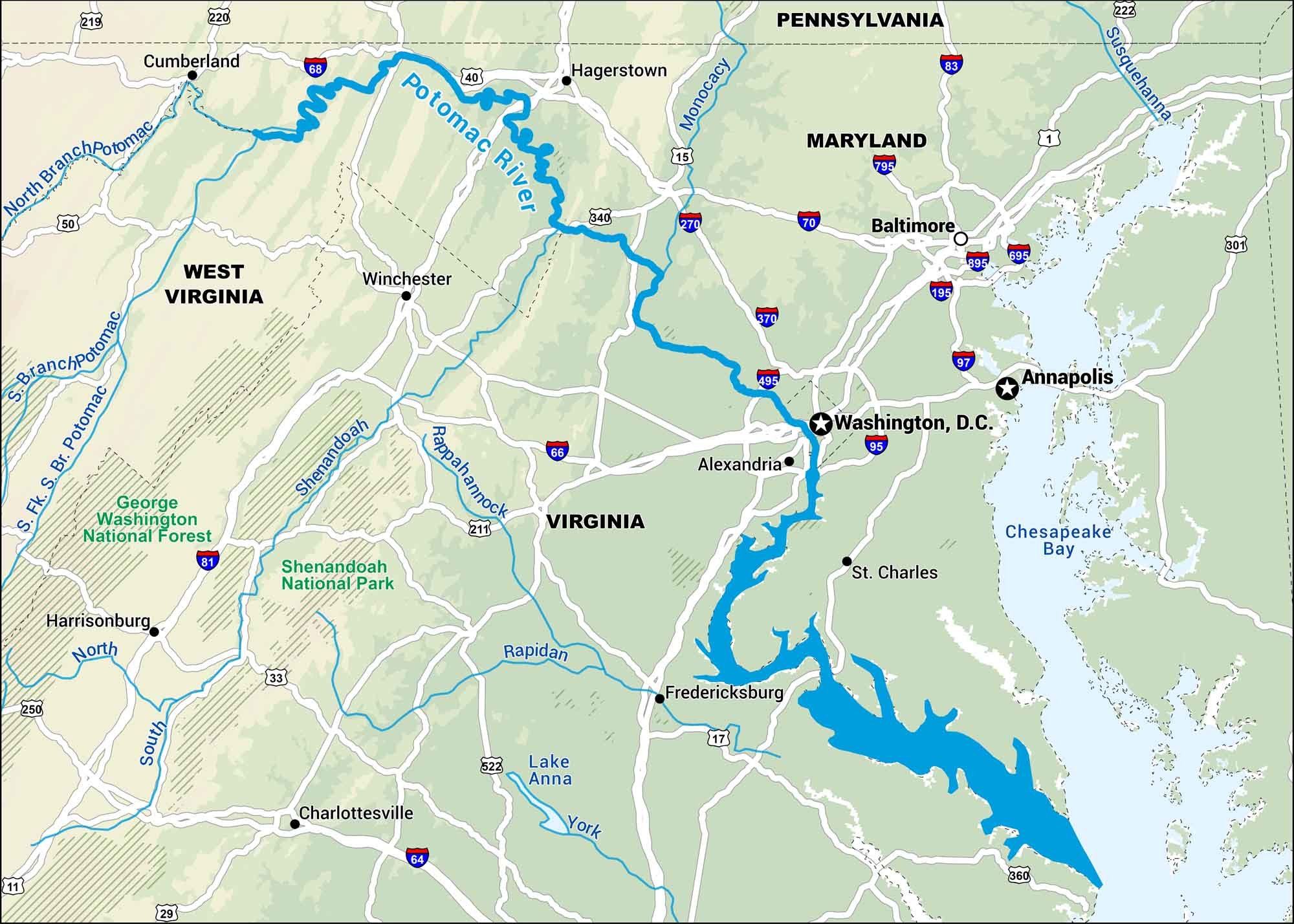
This map follows the Potomac River as it winds between Maryland and Virginia, right past Washington, D.C. It’s lined with monuments and eventually flows to Chesapeake Bay.
Map Information
On the Map
Interstates: I-68, I-70, I-81, I-83, I-95, I-97, I-195, I-270, I-370, I-495, I-695, I-795, I-895 Major Highways: US Hwy 1, US Hwy 15, US Hwy 29, US Hwy 33, US Hwy 40, US Hwy 50, US Hwy 211, US Hwy 219, US Hwy 220, US Hwy 222, US Hwy 301, US Hwy 340, US Hwy 522 Rivers/Lakes/Bays: North Branch Potomac River, S. Fk. S. Br. Potomac River, Potomac River, Monocacy River, Shenandoah River, Rappahannock River, Rapidan River, York River, South River, North River, Lake Anna, Chesapeake Bay National Forests and Parks: George Washington National Forest, Shenandoah National Park States: West Virginia, Pennsylvania, Maryland, Virginia Cities/Towns: Cumberland, Hagerstown, Winchester, Harrisonburg, Charlottesville, Baltimore, Washington, D.C., Alexandria, Fredericksburg, St. Charles, Annapolis
US Maps
Lakes and Rivers Map
Our map of America’s lakes and rivers shows the major waterways that define the country’s landscape.
Waterway Maps
Explore America’s waterways.


