Platte River Map
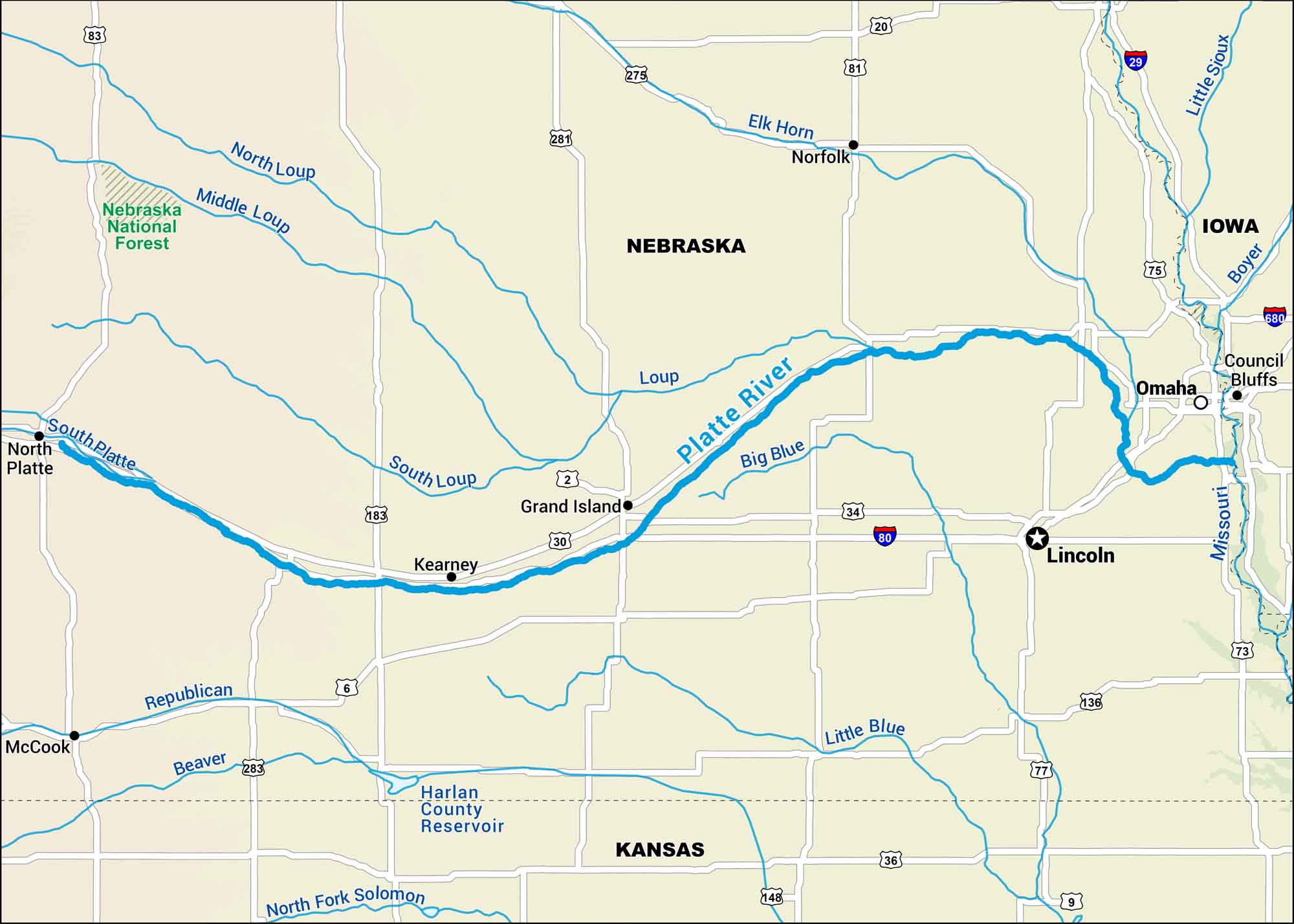
Our map of the Platte River shows its broad, shallow course across Nebraska. Sandhill cranes use it as a migration route as it runs through the Great Plains.
Map Information
On the Map
Interstates: I-80, I-29, I-680 Major Highways: US Hwy 30, US Hwy 83, US Hwy 183, US Hwy 281, US Hwy 275, US Hwy 81, US Hwy 20, US Hwy 75, US Hwy 34, US Hwy 77, US Hwy 136, US Hwy 36, US Hwy 283, US Hwy 6, State Rte 2, State Rte 9, State Rte 148 Rivers/Reservoirs: Platte River, North Platte River, South Platte River, North Loup River, Middle Loup River, South Loup River, Loup River, Missouri River, Elk Horn River, Big Blue River, Little Blue River, Republican River, Beaver Creek, Harlan County Reservoir National Forests: Nebraska National Forest States: Nebraska, Kansas, Iowa Cities/Towns: Grand Island, Omaha, Lincoln, Kearney, North Platte, Norfolk, Council Bluffs, McCook
US Maps
Lakes and Rivers Map
Our map of America’s lakes and rivers shows the major waterways that define the country’s landscape.
Waterway Maps
Explore America’s waterways.


