Pecos River Map
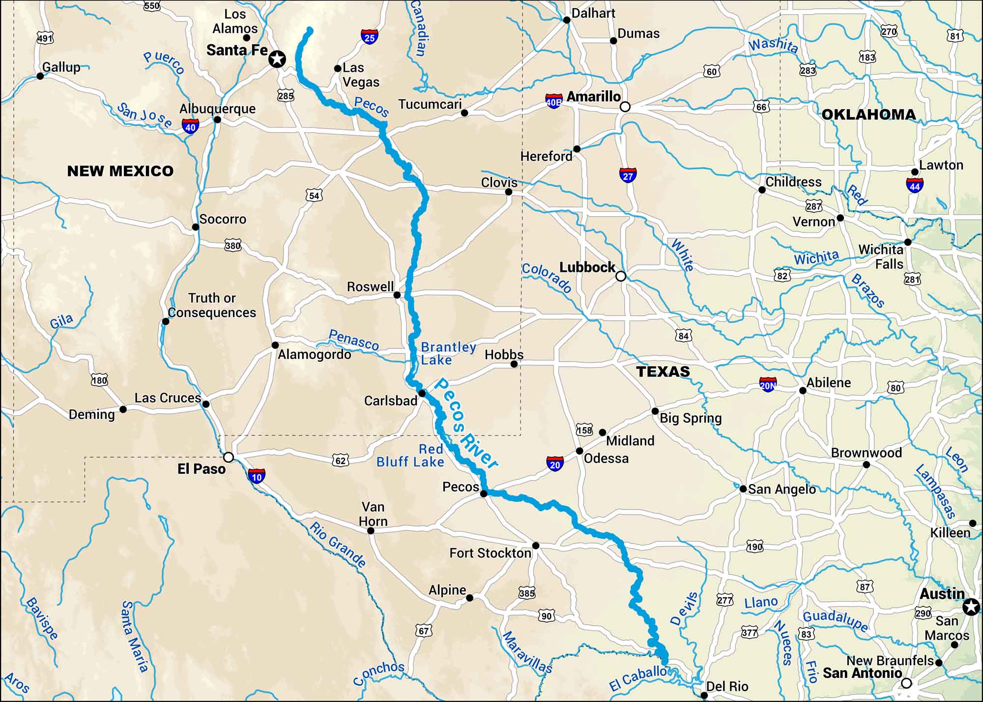
Our map of the Pecos River runs from the mountains of New Mexico through the dry plains of West Texas. It twists its path across the Southwest and eventually feeds into the Rio Grande far below.
Map Information
On the Map
Interstates: I-25, I-40, I-10, I-20, I-27, I-44 Major Highways: US Hwy 285, US Hwy 54, US Hwy 380, US Hwy 70, US Hwy 62, US Hwy 180, US Hwy 60, US Hwy 66, US Hwy 84, US Hwy 87, US Hwy 290, US Hwy 190, US Hwy 83, US Hwy 385, US Hwy 67, US Hwy 82 Major Rivers: Pecos River, Brantley Lake, Red Bluff Lake, Rio Grande, Canadian River, Washita River, Red River, Colorado River, Brazos River, Trinity River, Guadalupe River, Nueces River, San Jose River, Puerco River, Gila River, Conchos River States: New Mexico, Texas, Oklahoma Cities/Towns: Santa Fe, Albuquerque, Las Vegas, Roswell, Carlsbad, El Paso, Amarillo, Lubbock, Midland, Odessa, San Angelo, Austin, San Antonio, Abilene, Wichita Falls, Lawton, Tucumcari, Clovis, Pecos, Fort Stockton
US Maps
Lakes and Rivers Map
Our map of America’s lakes and rivers shows the major waterways that define the country’s landscape.
Waterway Maps
Explore America’s waterways.


