Ohio Physical Map
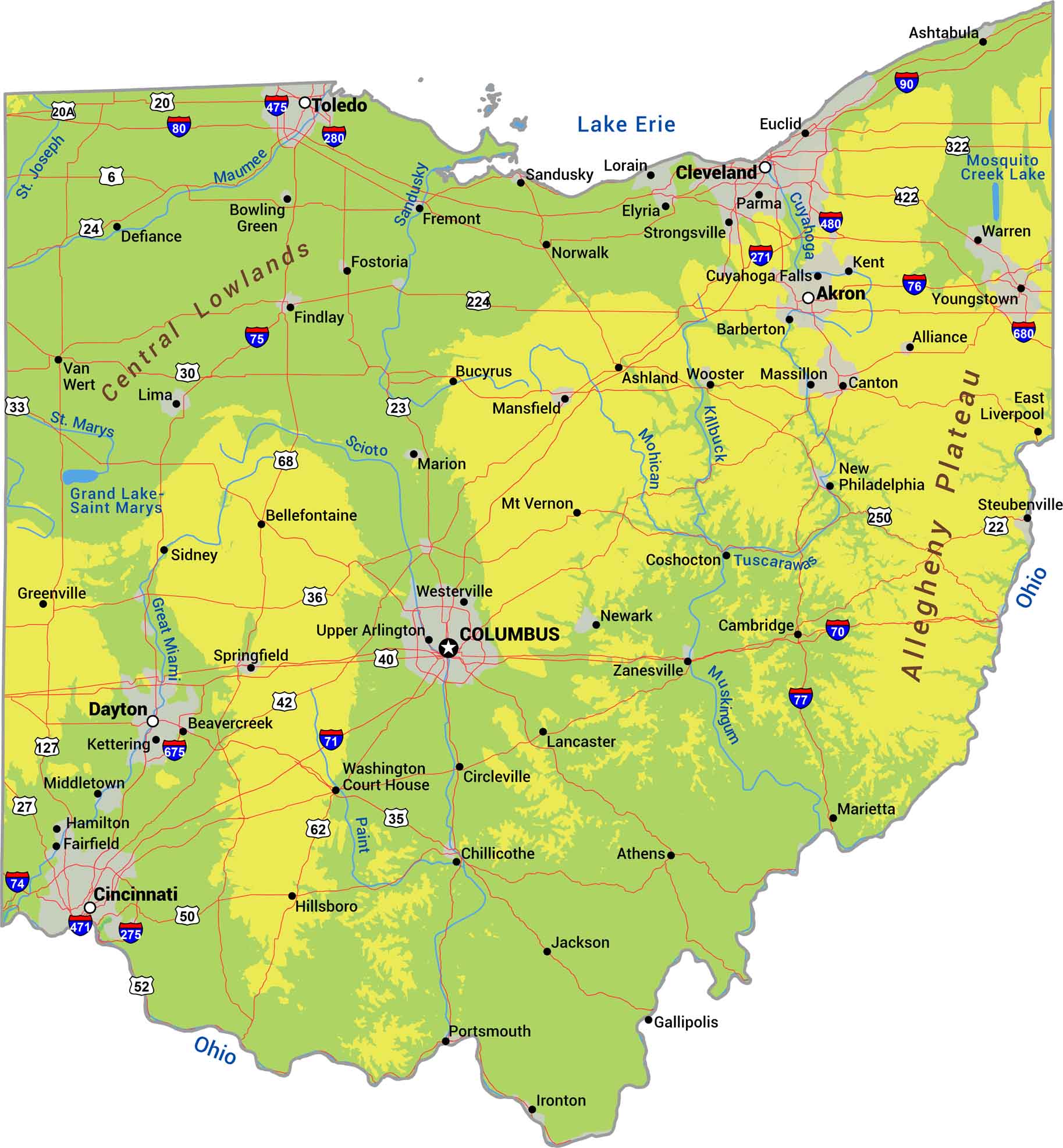
Ohio transitions from the Appalachian foothills and flattens out into farmland. The Lake Erie shoreline forms the northern border with marshes and beaches. Central and western Ohio are plains with gentle rolls with rivers like the Ohio, Scioto, and Muskingum. Our physical map shows Ohio’s terrain.
Map Information
On the Map
Physical State Maps
Select any state map below to view its physical map.


Ohio State Maps
Check out our maps covering farmland or any of Ohio’s major cities.


