Nueces River Map
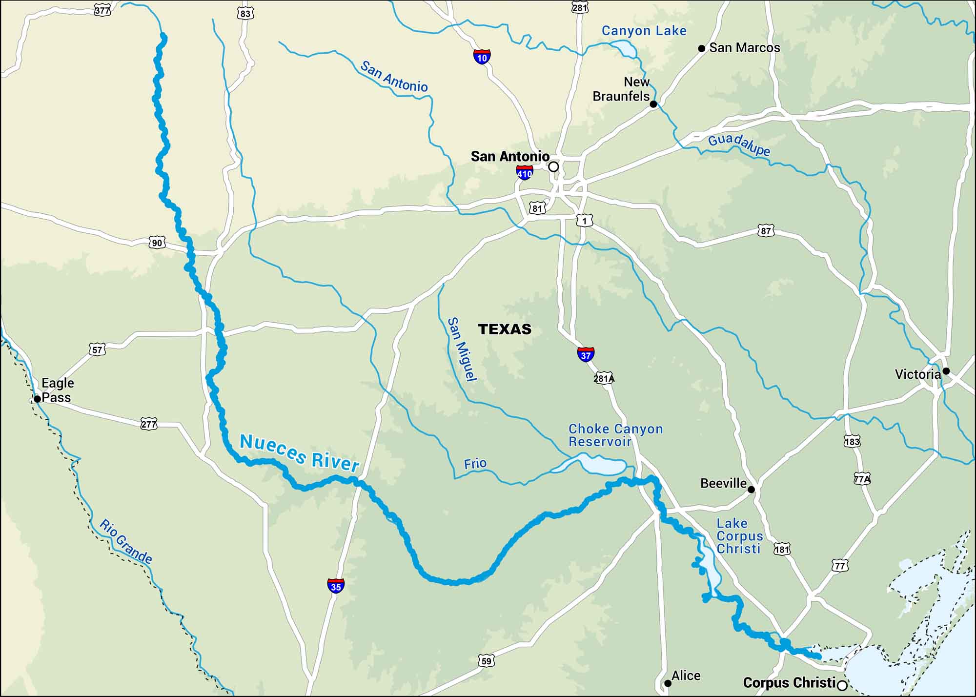
Our map of the Nueces River shows its flow from the Texas Hill Country down to Corpus Christi Bay. It cuts through dry ranchland before opening to the Gulf.
Map Information
On the Map
Interstates: I-10, I-35, I-37, I-410 Major Highways: US Hwy 377, US Hwy 83, US Hwy 90, US Hwy 57, US Hwy 277, US Hwy 59, US Hwy 281, US Hwy 281A, US Hwy 1, US Hwy 181, US Hwy 87, US Hwy 77, US Hwy 77A, US Hwy 183 Rivers/Reservoirs: Nueces River, Rio Grande River, Frio River, San Miguel River, San Antonio River, Guadalupe River, Choke Canyon Reservoir, Lake Corpus Christi, Canyon Lake States: Texas Cities/Towns: Corpus Christi, San Antonio, Alice, Beeville, Victoria, New Braunfels, San Marcos, Eagle Pass
US Maps
Lakes and Rivers Map
Our map of America’s lakes and rivers shows the major waterways that define the country’s landscape.
Waterway Maps
Explore America’s waterways.


