Missouri River Map
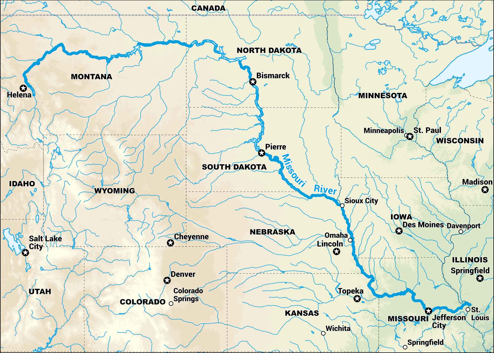
The Missouri starts in the Rockies and runs more than two thousand miles before meeting the Mississippi. On our map, you’ll see its wide bends through Montana, the Dakotas, and the plains beyond. It’s a path that built the backbone of the Midwest.
Map Information
On the Map
Interstates: I-15, I-90, I-94, I-29, I-80, I-70, I-35, I-44 Major Highways: US Hwy 2, US Hwy 83, US Hwy 12, US Hwy 20, US Hwy 30, US Hwy 75, US Hwy 36, US Hwy 50, US Hwy 63, US Hwy 65 Rivers: Missouri River States: Montana, North Dakota, South Dakota, Nebraska, Kansas, Missouri, Iowa, Minnesota, Wisconsin, Illinois, Wyoming, Colorado, Idaho, Utah Cities/Towns: Helena, Bismarck, Pierre, Sioux City, Omaha, Lincoln, Topeka, Wichita, Jefferson City, St. Louis, Springfield, Des Moines, Davenport, St. Paul, Minneapolis, Madison, Denver, Colorado Springs, Cheyenne, Salt Lake City Other Countries: Canada
US Maps
Lakes and Rivers Map
Our map of America’s lakes and rivers shows the major waterways that define the country’s landscape.
Waterway Maps
Explore America’s waterways.


