Mississippi River Map
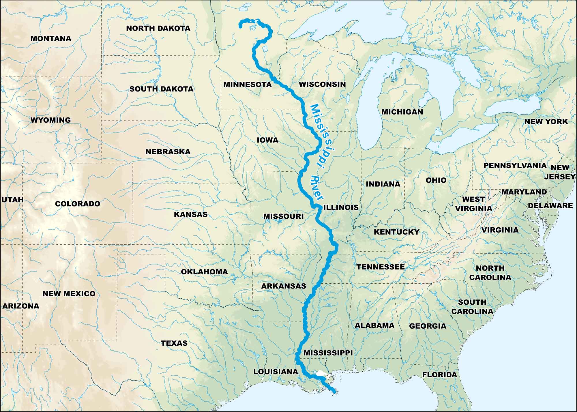
From Minnesota to the Gulf of Mexico, the Mississippi defines half the country. Our map focuses on all the states that it crosses and borders. It’s a river that shaped the land and the people who live beside it.
Map Information
On the Map
Rivers: Mississippi River States: Alabama, Arizona, Arkansas, Colorado, Delaware, Florida, Georgia, Illinois, Indiana, Iowa, Kansas, Kentucky, Louisiana, Maryland, Michigan, Minnesota, Mississippi, Missouri, Montana, Nebraska, New Jersey, New Mexico, New York, North Carolina, North Dakota, Ohio, Oklahoma, Pennsylvania, South Carolina, South Dakota, Tennessee, Texas, Utah, Virginia, West Virginia, Wisconsin, Wyoming
US Maps
Lakes and Rivers Map
Our map of America’s lakes and rivers shows the major waterways that define the country’s landscape.
Waterway Maps
Explore America’s waterways.


