Guadalupe River Map
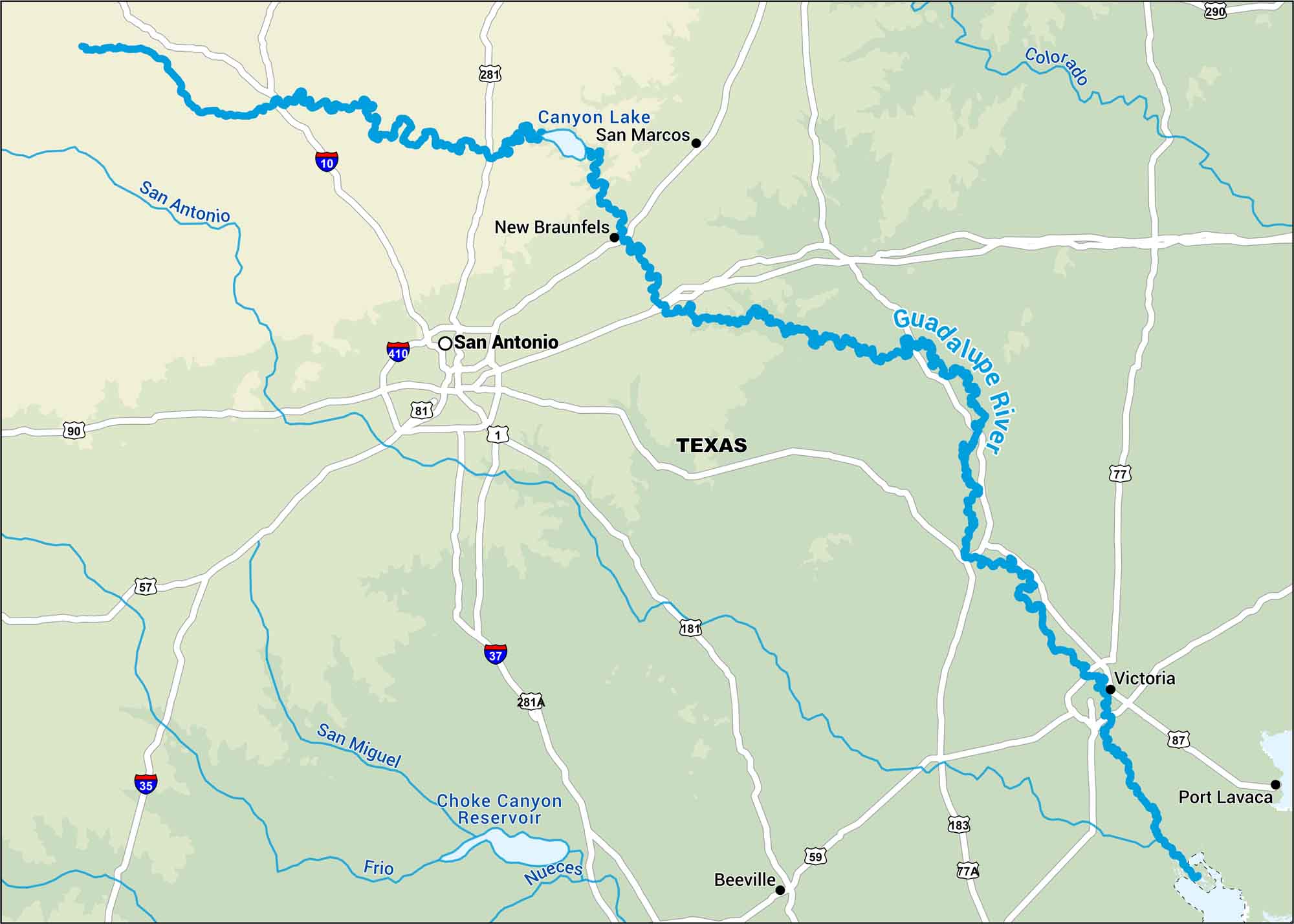
The Guadalupe flows from Texas Hill Country through towns like New Braunfels before meeting the Gulf. Our map shows highways, rivers, lakes and its close distance to San Antonio.
Map Information
On the Map
Interstates: I-10, I-35, I-37, I-410 Major Highways: US Hwy 57, US Hwy 59, US Hwy 77, US Hwy 81, US Hwy 87, US Hwy 90, US Hwy 181, US Hwy 183, US Hwy 281, US Hwy 290, State Rte 1, State Rte 77A, State Rte 281A Rivers/Reservoirs: Guadalupe River, Colorado River, Frio River, Nueces River, San Antonio River, San Miguel River, Canyon Lake, Choke Canyon Reservoir States: Texas Cities/Towns: San Antonio, Beeville, New Braunfels, Port Lavaca, San Marcos, Victoria
US Maps
Lakes and Rivers Map
Our map of America’s lakes and rivers shows the major waterways that define the country’s landscape.
Waterway Maps
Explore America’s waterways.


