French Broad River Map
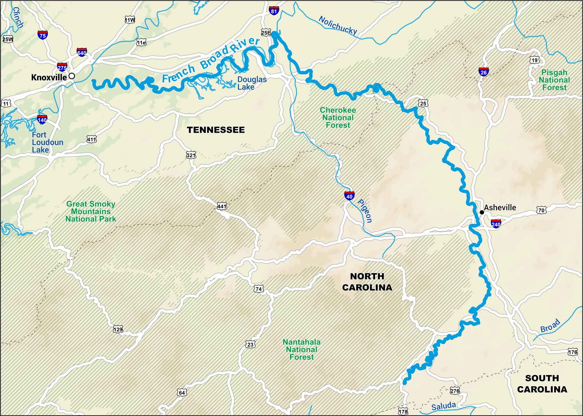
The French Broad runs out of North Carolina’s mountains and into Tennessee’s valleys. Use our map to follow its wide bends through Asheville and on toward Knoxville.
Map Information
On the Map
Interstates: I-26, I-40, I-75, I-81, I-140, I-240, I-275, I-640 Major Highways: US Hwy 11, US Hwy 11W, US Hwy 11E, US Hwy 19, US Hwy 23, US Hwy 25, US Hwy 25E, US Hwy 64, US Hwy 70, US Hwy 74, US Hwy 129, US Hwy 176, US Hwy 178, US Hwy 276, US Hwy 321, US Hwy 411, US Hwy 441 Rivers/Lakes: French Broad River, Nolichucky River, Pigeon River, Broad River, Clinch River, Douglas Lake, Fort Loudoun Lake Parks/Forests: Great Smoky Mountains National Park, Cherokee National Forest, Pisgah National Forest, Nantahala National Forest States: Tennessee, North Carolina, South Carolina Cities/Towns: Knoxville, Asheville, Saluda
US Maps
Lakes and Rivers Map
Our map of America’s lakes and rivers shows the major waterways that define the country’s landscape.
Waterway Maps
Explore America’s waterways.


