Deschutes River Map
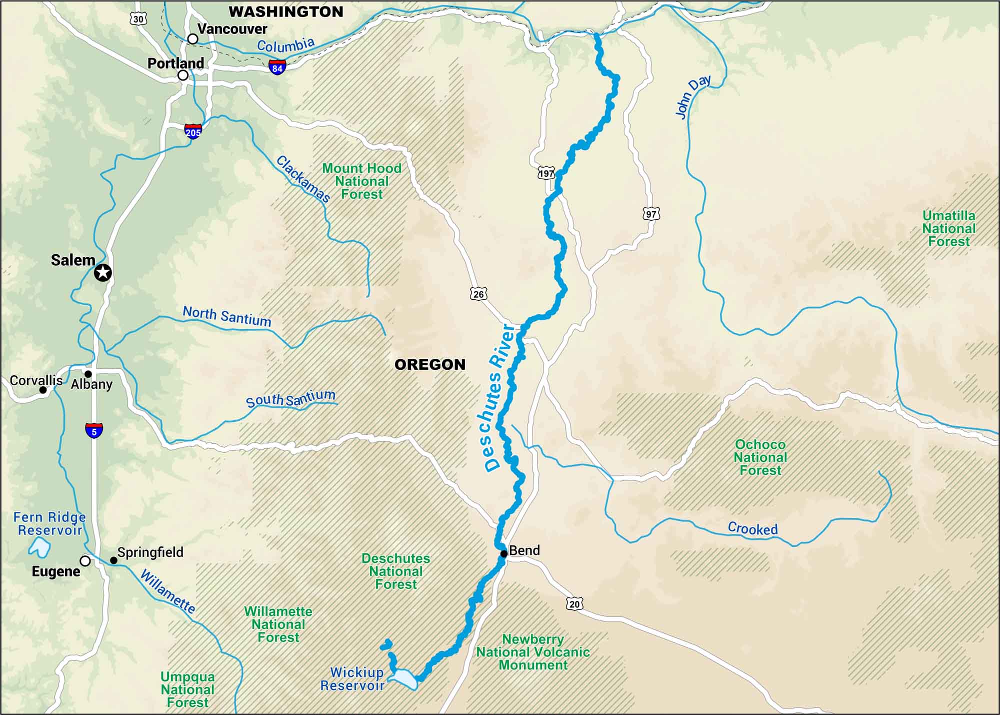
The Deschutes River flows through central Oregon, cutting through pine forests on its way to the Columbia River. Our map shows every twist along this legendary stretch of the Pacific Northwest.
Map Information
On the Map
Interstates: I-5, I-84, I-205 Major Highways: US Hwy 20, US Hwy 26, US Hwy 30, US Hwy 97, US Hwy 197 Rivers/Reservoirs: Deschutes River, Columbia River, Willamette River, Clackamas River, North Santium River, South Santium River, Crooked River, John Day River, Wickiup Reservoir, Fern Ridge Reservoir Parks/Forests: Mount Hood National Forest, Deschutes National Forest, Willamette National Forest, Umpqua National Forest, Umatilla National Forest, Ochoco National Forest, Newberry National Volcanic Monument States: Oregon, Washington Cities/Towns: Portland, Salem, Eugene, Bend, Vancouver, Springfield, Albany, Corvallis
US Maps
Lakes and Rivers Map
Our map of America’s lakes and rivers shows the major waterways that define the country’s landscape.
Waterway Maps
Explore America’s waterways.


