Des Moines River Map
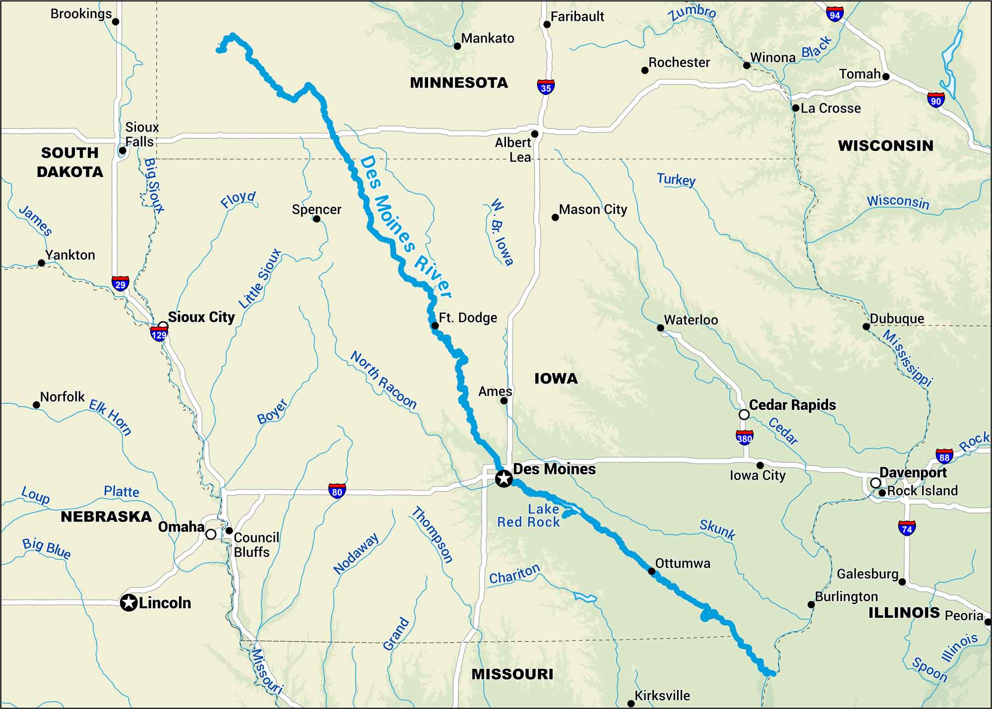
Running from southern Minnesota through Iowa, the Des Moines River winds past farms and the capital city itself. Our map lays out its course clearly, from calm stretches near Lake Red Rock to bends that define the Iowa landscape.
Map Information
On the Map
Interstates: I-29, I-35, I-74, I-80, I-88, I-90, I-94, I-129, I-380 Major Highways: US Hwy 169 Rivers/Lakes: Des Moines River, Missouri River, Mississippi River, W Br Iowa River, Cedar River, North Raccoon River, Skunk River, Thompson River, Chariton River, Little Sioux River, Big Sioux River, Floyd River, Boyer River, Nodaway River, Grand River, Turkey River, Zumbro River, Black River, Spoon River, Illinois River, Lake Red Rock States: Iowa, Minnesota, Missouri, Nebraska, South Dakota, Illinois, Wisconsin Cities/Towns: Des Moines, Omaha, Lincoln, Sioux City, Sioux Falls, Davenport, Cedar Rapids, Waterloo, Ames, Ft Dodge, Ottumwa, Iowa City, Mason City, Mankato, Rochester, La Crosse, Winona, Dubuque, Rock Island, Council Bluffs
US Maps
Lakes and Rivers Map
Our map of America’s lakes and rivers shows the major waterways that define the country’s landscape.
Waterway Maps
Explore America’s waterways.


