Delaware River Map
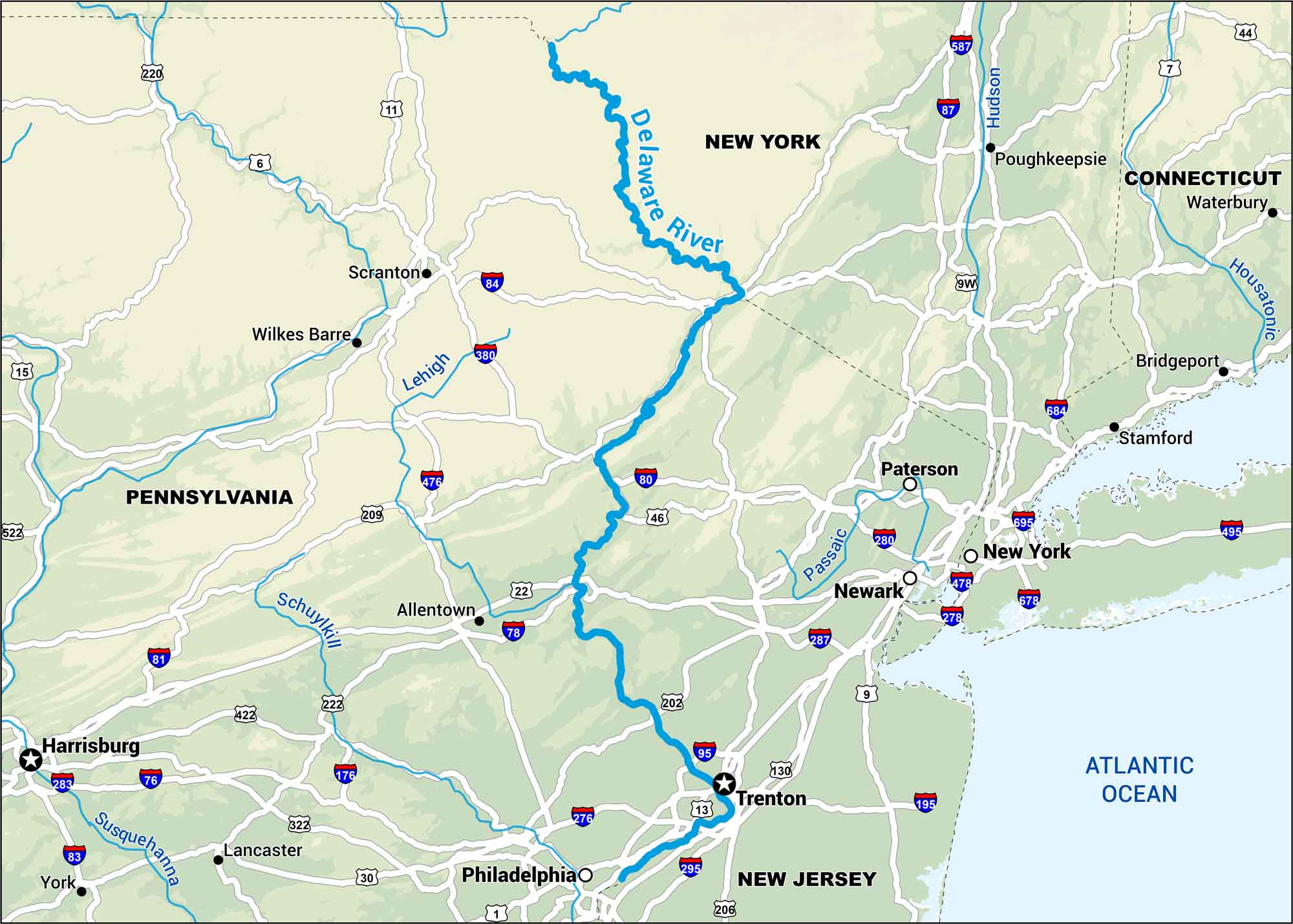
The Delaware River forms the boundary between Pennsylvania and New Jersey before flowing to the Atlantic. Our map highlights its scenic routes through the Mid-Atlantic.
Map Information
On the Map
Interstates: I-76, I-78, I-80, I-81, I-83, I-84, I-87, I-95, I-195, I-276, I-278, I-280, I-283, I-287, I-295, I-380, I-476, I-478, I-495, I-587, I-678 Major Highways: US Hwy 1, US Hwy 6, US Hwy 7, US Hwy 9, US Hwy 9W, US Hwy 11, US Hwy 13, US Hwy 15, US Hwy 22, US Hwy 30, US Hwy 44, US Hwy 46, US Hwy 130, US Hwy 202, US Hwy 206, US Hwy 209, US Hwy 220, US Hwy 222, US Hwy 322, US Hwy 422 Rivers/Oceans: Delaware River, Schuylkill River, Susquehanna River, Lehigh River, Passaic River, Hudson River, Housatonic River, Atlantic Ocean States: Pennsylvania, New Jersey, New York, Connecticut Cities/Towns: Philadelphia, New York, Newark, Trenton, Allentown, Scranton, Harrisburg, Lancaster, Wilkes Barre, Paterson, Poughkeepsie, Waterbury, Bridgeport, Stamford, York
US Maps
Lakes and Rivers Map
Our map of America’s lakes and rivers shows the major waterways that define the country’s landscape.
Waterway Maps
Explore America’s waterways.


