Connecticut River Map
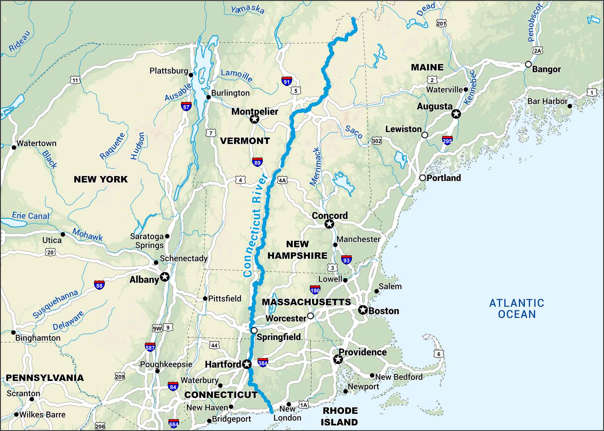
New England’s longest river runs from northern New Hampshire to Long Island Sound. Our map shows this lengthy river with nearby cities and roads.
Map Information
On the Map
Interstates/Highways: I-5, I-84, I-87, I-88, I-89, I-91, I-93, I-190, I-295, I-384, I-587, I-684 Major Roads: US Hwy 1, US Hwy 1A, US Hwy 2, US Hwy 2A, US Hwy 3, US Hwy 4, US Hwy 4A, US Hwy 5, US Hwy 6, US Hwy 7, US Hwy 9, US Hwy 9W, US Hwy 11, US Hwy 20, US Hwy 44, US Hwy 201, US Hwy 202, US Hwy 206, US Hwy 209, US Hwy 302 Rivers/Lakes: Connecticut River, Atlantic Ocean, Yamaska, Dead, Penobscot, Kennebec, Saco, Merrimack, Lamoille, Ausable, Hudson, Raquette, Black, Mohawk, Erie Canal, Susquehanna, Delaware, Rideau States: Connecticut, Massachusetts, Vermont, New Hampshire, Maine, Rhode Island, New York, Pennsylvania Cities/Towns: Boston, Providence, Hartford, Albany, Montpelier, Concord, Augusta, Bangor, Bar Harbor, Waterville, Lewiston, Portland, Manchester, Lowell, Salem, Worcester, Springfield, Pittsfield, New Haven, Bridgeport, New London, Newport, New Bedford, Waterbury, Poughkeepsie, Saratoga Springs, Schenectady, Utica, Watertown, Plattsburgh, Burlington, Binghamton, Scranton, Wilkes Barre
US Maps
Lakes and Rivers Map
Our map of America’s lakes and rivers shows the major waterways that define the country’s landscape.
Waterway Maps
Explore America’s waterways.


