Chattooga River Map
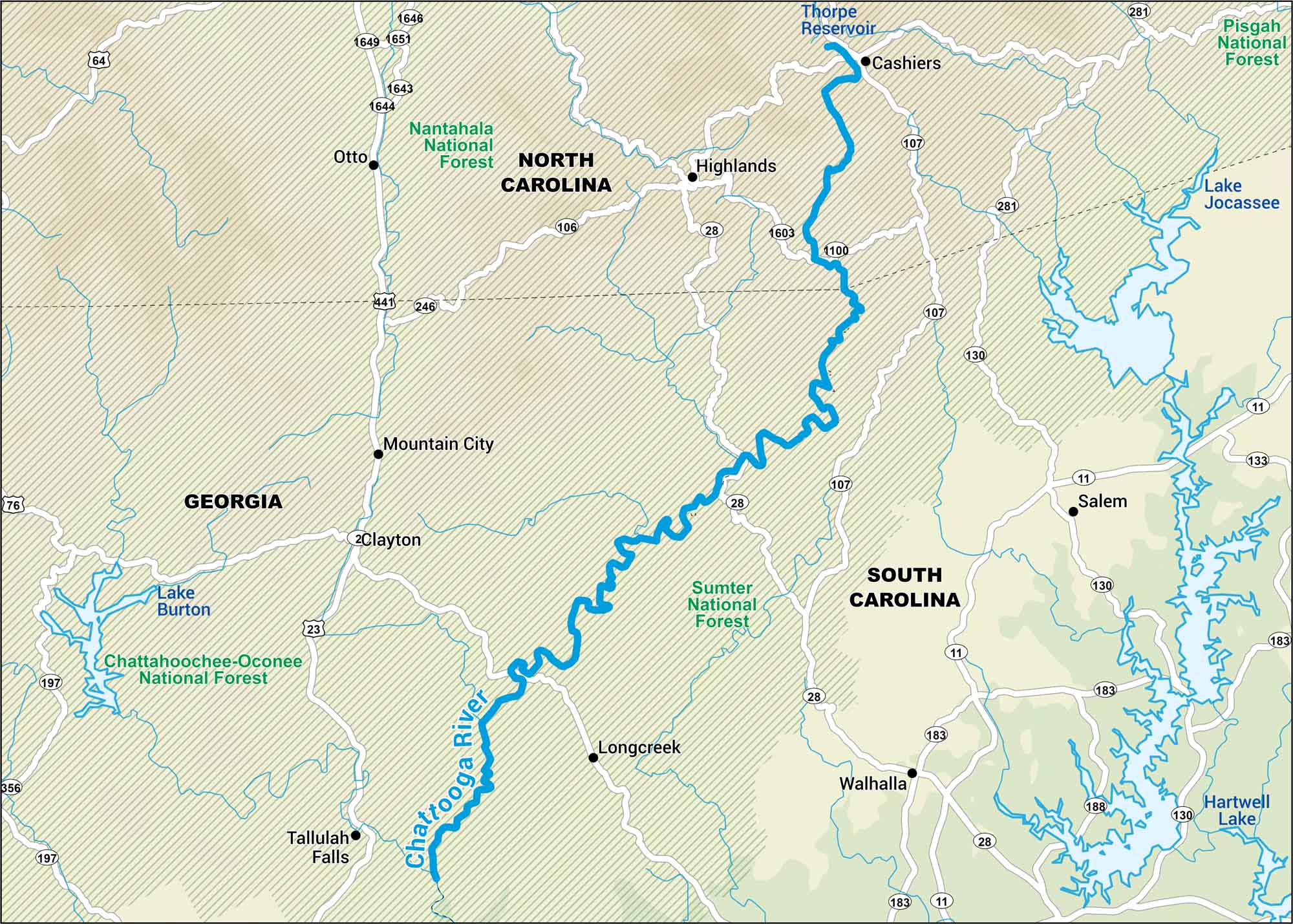
Go chase the rapids. The Chattooga River roars through wild Georgia-South Carolina country. This map leads you along the gorge, down the border line where the wilderness still wins.
Map Information
On the Map
Major Roads: US Hwy 64, US Hwy 76, US Hwy 441, US Hwy 23, State Rte 28, State Rte 107, State Rte 11, State Rte 106, State Rte 246, State Rte 197, State Rte 356, State Rte 130, State Rte 133, State Rte 183, State Rte 188, State Rte 281 Rivers/Lakes: Chattooga River, Thorpe Reservoir, Lake Burton, Lake Jocassee, Hartwell Lake Major Forests: Nantahala National Forest, Pisgah National Forest, Chattahoochee-Oconee National Forest, Sumter National Forest Cities/Towns: Cashiers, Highlands, Otto, Mountain City, Clayton, Tallulah Falls, Longcreek, Walhalla, Salem
US Maps
Lakes and Rivers Map
Our map of America’s lakes and rivers shows the major waterways that define the country’s landscape.
Waterway Maps
Explore America’s waterways.


