Catawba River Map
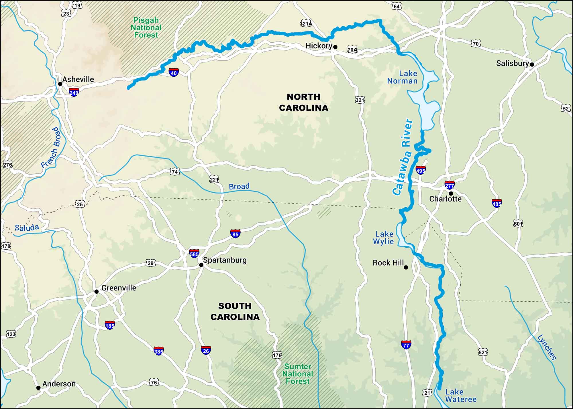
Here’s the Catawba River. It’s steady, working, and alive. It feeds lakes and threads through Carolina towns. These towns grew up on its banks. Follow the river on our map and see how this river ties the region together.
Map Information
On the Map
Interstates: I-26, I-40, I-77, I-85, I-185, I-240, I-277, I-385, I-485, I-495, I-585 Major Highways: US Hwy 19, US Hwy 21, US Hwy 23, US Hwy 25, US Hwy 29, US Hwy 52, US Hwy 64, US Hwy 70, US Hwy 74, US Hwy 176, US Hwy 221, US Hwy 321, US Hwy 521, US Hwy 601, State Rte 321A, State Rte 70A Rivers/Lakes: Catawba River, Lake Norman, Lake Wylie, Lake Wateree, French Broad, Broad, Lynches Parks and Forests: Pisgah National Forest, Sumter National Forest Cities/Towns: Asheville, Hickory, Charlotte, Rock Hill, Gastonia, Salisbury, Spartanburg, Greenville, Anderson
US Maps
Lakes and Rivers Map
Our map of America’s lakes and rivers shows the major waterways that define the country’s landscape.
Waterway Maps
Explore America’s waterways.


