Ausable River Map
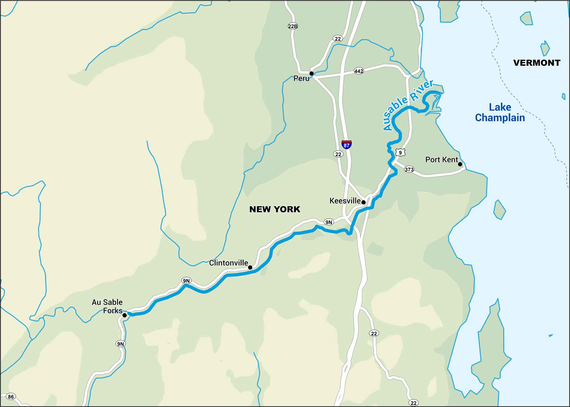
Cold water, tight turns, and the Adirondacks rising close around it. It doesn’t get any sweeter than this. See our map of the Ausable River, a classic North Country run.
Map Information
On the Map
Interstates/Highways: I-87 Major Roads: US Hwy 9, State Rte 9N, State Rte 22, State Rte 22B, State Rte 86, State Rte 373, State Rte 442 Rivers/Lakes: Ausable River, Lake Champlain Cities/Towns: Keeseville, Clintonville, Au Sable Forks, Port Kent, Peru
US Maps
Lakes and Rivers Map
Our map of America’s lakes and rivers shows the major waterways that define the country’s landscape.
Waterway Maps
Explore America’s waterways.


