Au Sable River Map
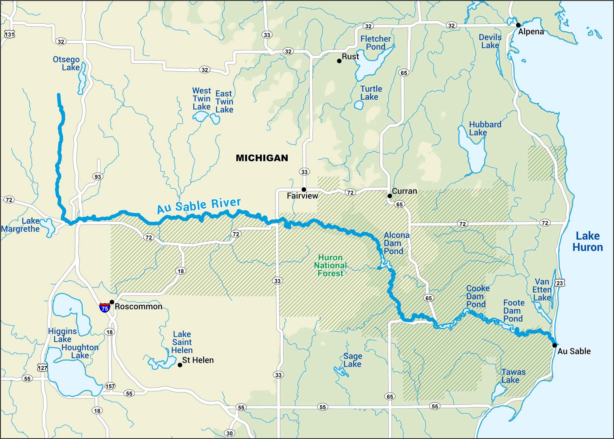
Michigan’s Au Sable drifts through pine forest and small towns. It’s steady and calm. Follow the map to find launch points, camp spots, and the quiet stretches of the river.
Map Information
On the Map
Interstates/Highways: I-75 Major Roads: State Rte 72, State Rte 65, State Rte 33, State Rte 32, State Rte 18, State Rte 55, US Hwy 23, US Hwy 131, US Hwy 127, State Rte 30, State Rte 93 Rivers/Lakes: Au Sable River, Lake Huron, Lake Margrethe, Higgins Lake, Houghton Lake, Lake Saint Helen, Sage Lake, Tawas Lake, Van Etten Lake, Cooke Dam Pond, Foote Dam Pond, Alcona Dam Pond, Loud Dam Pond, Five Channels Dam Pond, Hubbard Lake, Devils Lake, Fletcher Pond, Turtle Lake, East Twin Lake, West Twin Lake, Otsego Lake Parks/Forests: Huron National Forest Cities/Towns: Alpena, Au Sable, Roscommon, Fairview, Curran, St Helen, Rust
US Maps
Lakes and Rivers Map
Our map of America’s lakes and rivers shows the major waterways that define the country’s landscape.
Waterway Maps
Explore America’s waterways.


