Arkansas River Map
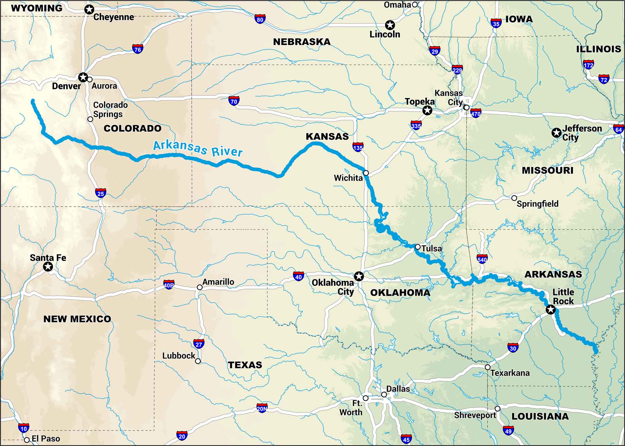
The Arkansas starts high in the Rockies and rolls all the way to the plains. Our map tracks it through canyons, farmland, and cities. It’s a wild ride that never quite settles down.
Map Information
On the Map
Interstates: I-25, I-70, I-80, I-76, I-35, I-29, I-40, I-30, I-49, I-45, I-10, I-20, I-172, I-72 Major Highways: US Hwy 40, US Hwy 287, US Hwy 50, US Hwy 540, US Hwy 64, US Hwy 135, US Hwy 229, US Hwy 335, US Hwy 470 Rivers: Arkansas River Cities/Towns: Little Rock, Tulsa, Oklahoma City, Wichita, Topeka, Kansas City, Jefferson City, Springfield, Denver, Colorado Springs, Aurora, Santa Fe, Amarillo, Lubbock, Dallas, Ft. Worth, Shreveport, Texarkana, El Paso, Cheyenne, Lincoln
US Maps
Lakes and Rivers Map
Our map of America’s lakes and rivers shows the major waterways that define the country’s landscape.
Waterway Maps
Explore America’s waterways.


