Salmon River Map
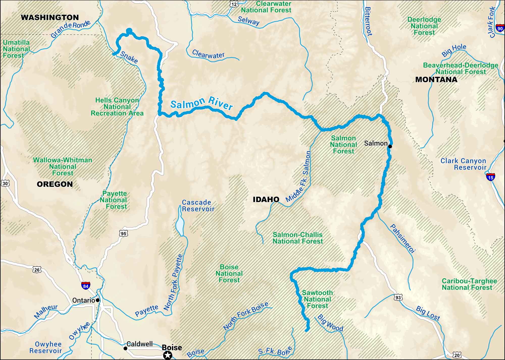
Our map of the Salmon River cuts through the heart of Idaho’s wilderness. Known as “The River of No Return”, it flows through deep canyons and untouched land.
Map Information
On the Map
Interstates: I-15, I-84, I-90 Major Highways: US Hwy 12, US Hwy 20, US Hwy 26, US Hwy 30, US Hwy 93, US Hwy 95 Rivers/Reservoirs: Salmon River, Snake River, Clearwater River, Selway River, Bitterroot River, Big Hole River, Clark Fork River, Pahsimeroi River, Big Lost River, Big Wood River, Boise River, Payette River, Owyhee River, Malheur River, Grande Ronde River, Cascade Reservoir, Clark Canyon Reservoir, Owyhee Reservoir National Forests: Clearwater National Forest, Salmon National Forest, Salmon-Challis National Forest, Sawtooth National Forest, Boise National Forest, Payette National Forest, Wallowa-Whitman National Forest, Umatilla National Forest, Beaverhead-Deerlodge National Forest States: Idaho, Oregon, Washington, Montana Cities/Towns: Boise, Salmon, Ontario, Caldwell
US Maps
Lakes and Rivers Map
Our map of America’s lakes and rivers shows the major waterways that define the country’s landscape.
Waterway Maps
Explore America’s waterways.


