Savannah River Map
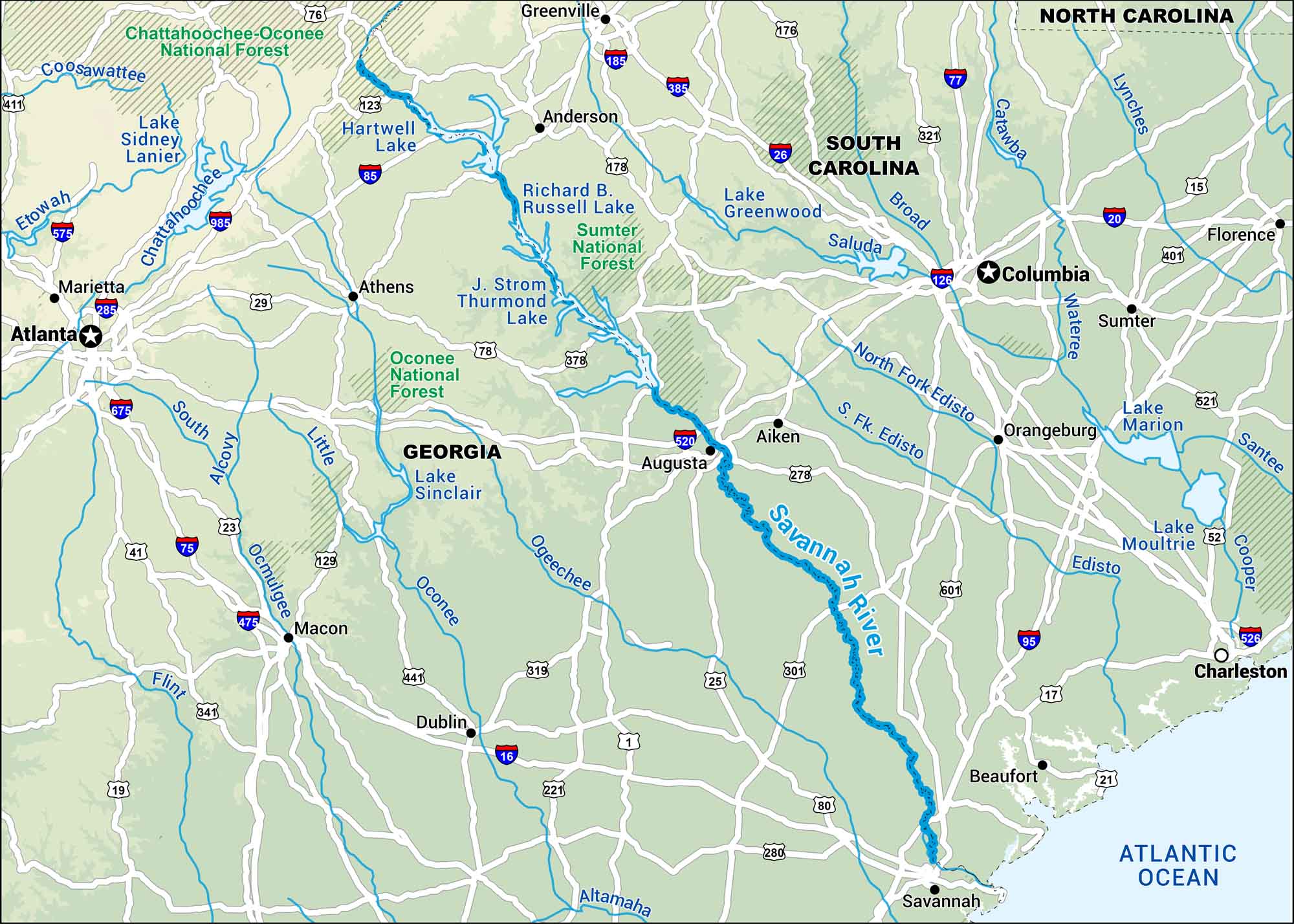
The Savannah River forms much of the border between Georgia and South Carolina. Our map shows how it winds from the foothills to the coast. Finally, it unwinds where its delta fans out near historic Savannah.
Map Information
On the Map
Interstates: I-16, I-20, I-26, I-75, I-77, I-85, I-95, I-126, I-185, I-285, I-385, I-475, I-520, I-526, I-575, I-675, I-985 Major Highways: US Hwy 1, US Hwy 15, US Hwy 17, US Hwy 19, US Hwy 21, US Hwy 23, US Hwy 25, US Hwy 29, US Hwy 52, US Hwy 75, US Hwy 76, US Hwy 78, US Hwy 80, US Hwy 123, US Hwy 129, US Hwy 176, US Hwy 178, US Hwy 221, US Hwy 278, US Hwy 280 Rivers/Lakes: Savannah River, Chattahoochee River, Coosawattee River, Etowah River, Ocmulgee River, Oconee River, Ogeechee River, Flint River, Alcovy River, South River, Little River, Saluda River, Broad River, Catawba River, Lynches River, Wateree River, Edisto River, North Fork Edisto River, S. Fk. Edisto River, Santee River, Cooper River, Lake Sidney Lanier, Hartwell Lake, Richard B. Russell Lake, J. Strom Thurmond Lake, Lake Sinclair, Lake Greenwood, Lake Marion, Lake Moultrie, Atlantic Ocean National Forests: Chattahoochee-Oconee National Forest, Sumter National Forest, Oconee National Forest States: Georgia, South Carolina, North Carolina Cities/Towns: Atlanta, Columbia, Charleston, Augusta, Savannah, Macon, Athens, Greenville, Anderson, Aiken, Florence, Sumter, Orangeburg, Beaufort, Marietta, Dublin
US Maps
Lakes and Rivers Map
Our map of America’s lakes and rivers shows the major waterways that define the country’s landscape.
Waterway Maps
Explore America’s waterways.


