Roanoke River Map
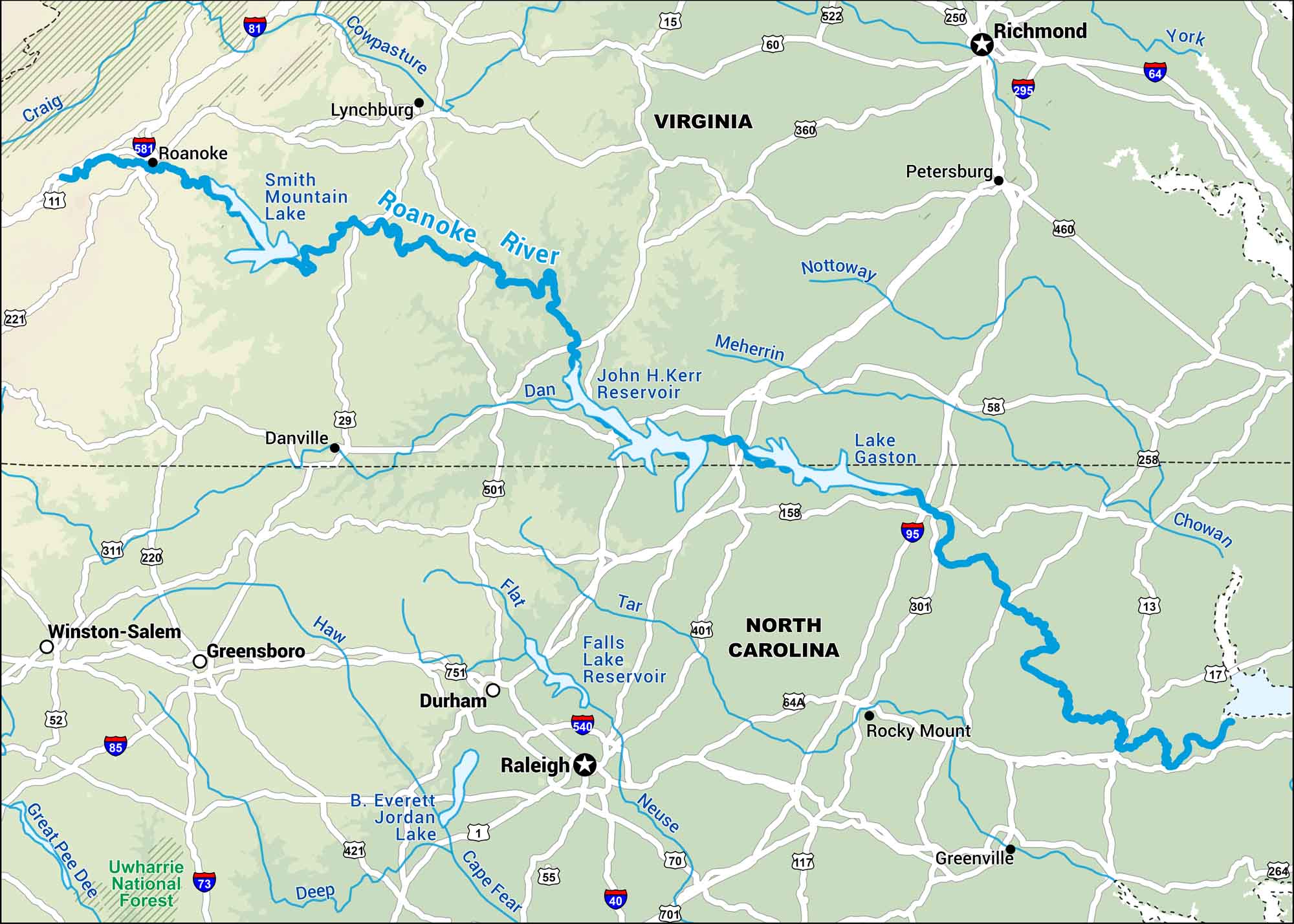
This map displays the Roanoke River from Virginia’s Blue Ridge Mountains down into North Carolina. The river winds through swamps and forests before reaching Albemarle Sound.
Map Information
On the Map
Interstates: I-40, I-64, I-73, I-81, I-85, I-95, I-295, I-540, I-581 Major Highways: US Hwy 1, US Hwy 11, US Hwy 13, US Hwy 15, US Hwy 17, US Hwy 29, US Hwy 58, US Hwy 60, US Hwy 70, US Hwy 117, US Hwy 158, US Hwy 220, US Hwy 221, US Hwy 250, US Hwy 258, US Hwy 301, US Hwy 311, US Hwy 360, US Hwy 401, US Hwy 421 Rivers/Lakes: Cowpasture River, Craig River, Roanoke River, Dan River, Meherrin River, Nottoway River, York River, Chowan River, Tar River, Neuse River, Cape Fear River, Flat River, Haw River, Deep River, Great Pee Dee River, Smith Mountain Lake, John H. Kerr Reservoir, Lake Gaston, Falls Lake Reservoir, B. Everett Jordan Lake National Forests: Uwharrie National Forest States: Virginia, North Carolina Cities/Towns: Roanoke, Lynchburg, Danville, Richmond, Petersburg, Winston-Salem, Greensboro, Durham, Raleigh, Rocky Mount, Greenville
US Maps
Lakes and Rivers Map
Our map of America’s lakes and rivers shows the major waterways that define the country’s landscape.
Waterway Maps
Explore America’s waterways.


