Ohio River Map
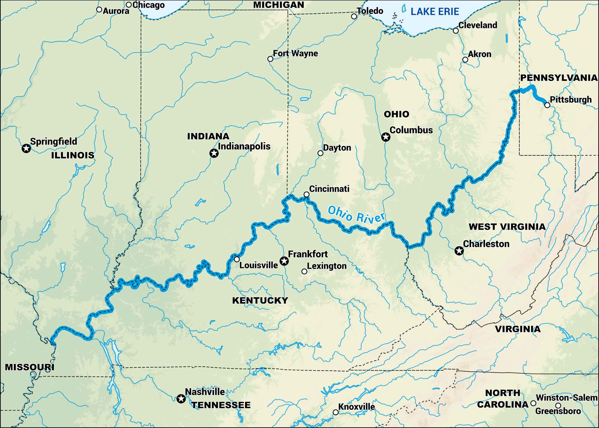
Our map of the Ohio River follows its long course from Pittsburgh to the Mississippi. It forms the borders of Illinois, Kentucky, Indiana, Ohio and West Virginia. It’s a river that shaped settlement across the Midwest.
Map Information
On the Map
Rivers/Lakes: Ohio River, Lake Erie States: Illinois, Indiana, Ohio, Pennsylvania, Kentucky, West Virginia, Virginia, Missouri, Tennessee, North Carolina, Michigan Cities/Towns: Chicago, Aurora, Toledo, Cleveland, Akron, Pittsburgh, Columbus, Dayton, Cincinnati, Indianapolis, Fort Wayne, Louisville, Frankfort, Lexington, Charleston, Springfield, Nashville, Knoxville, Winston-Salem, Greensboro
US Maps
Lakes and Rivers Map
Our map of America’s lakes and rivers shows the major waterways that define the country’s landscape.
Waterway Maps
Explore America’s waterways.


