Madison River Map
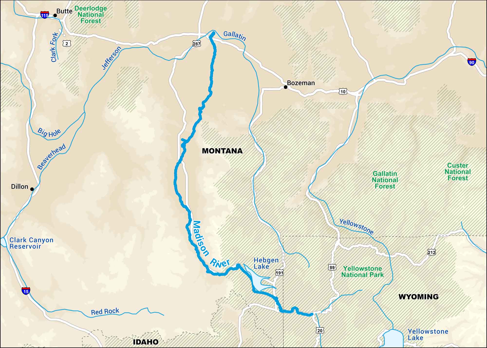
The Madison begins inside Yellowstone and flows through open Montana. Our map shows its wide turns and local roads. They’re the ones locals know by heart.
Map Information
On the Map
Interstates: I-15, I-90, I-115 Major Highways: US Hwy 2, US Hwy 10, US Hwy 20, US Hwy 89, US Hwy 191, US Hwy 212, US Hwy 287Rivers/Lakes: Madison River, Beaverhead River, Big Hole River, Clark Fork River, Gallatin River, Jefferson River, Red Rock River, Yellowstone River, Clark Canyon Reservoir, Hebgen Lake, Yellowstone Lake
National Parks and Forests: Yellowstone National Park, Custer National Forest, Deerlodge National Forest, Gallatin National Forest States: Idaho, Montana, Wyoming Cities/Towns: Bozeman, Butte, Dillon
US Maps
Lakes and Rivers Map
Our map of America’s lakes and rivers shows the major waterways that define the country’s landscape.
Waterway Maps
Explore America’s waterways.


