Green River Map
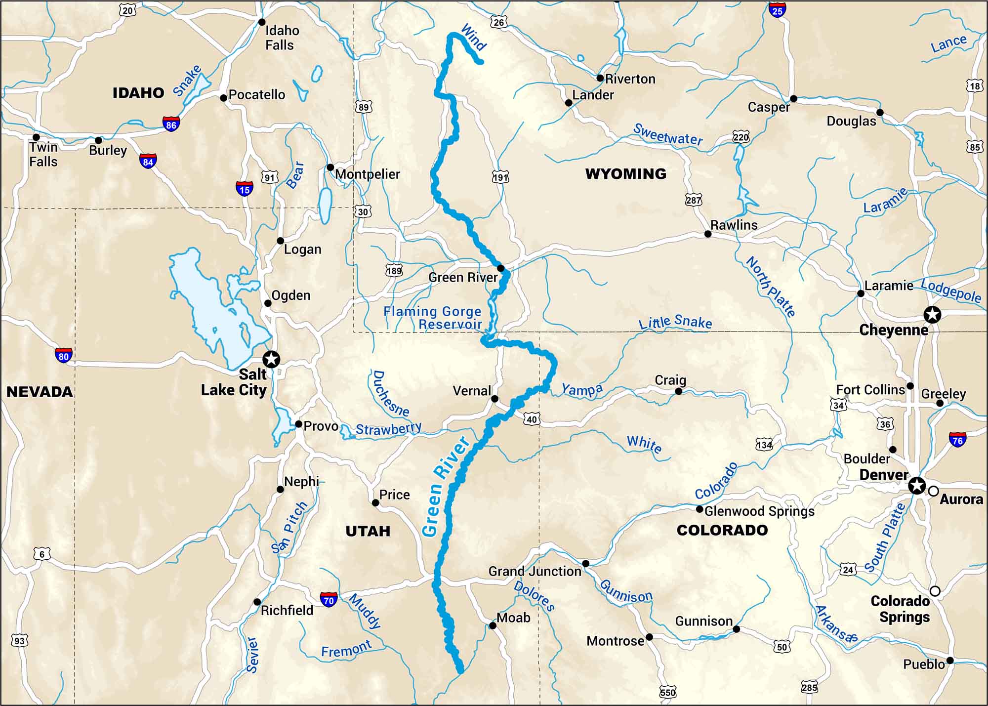
Cutting through Wyoming and Utah, the Green River carves deep canyons. Our map shows the wild stretches and remote access area that define it.
Map Information
On the Map
Interstates: I-15, I-25, I-70, I-76, I-80, I-84, I-86 Major Highways: US Hwy 18, US Hwy 20, US Hwy 26, US Hwy 30, US Hwy 34, US Hwy 36, US Hwy 40, US Hwy 50, US Hwy 85, US Hwy 89, US Hwy 189, US Hwy 191, US Hwy 285, US Hwy 287, US Hwy 550, State Rte 6, State Rte 91, State Rte 93, State Rte 134, State Rte 220 Rivers/Lakes: Green River, Arkansas River, Bear River, Colorado River, Dolores River, Duchesne River, Gunnison River, Laramie River, Little Snake River, Muddy River, North Platte River, Price River, San Pitch River, Sevier River, South Platte River, Strawberry River, Sweetwater River, White River, Wind River, Yampa River, Flaming Gorge Reservoir, Salt Lake States: Colorado, Idaho, Nevada, Utah, Wyoming Cities/Towns: Denver, Salt Lake City, Aurora, Boulder, Casper, Cheyenne, Colorado Springs, Fort Collins, Grand Junction, Greeley, Idaho Falls, Laramie, Logan, Montrose, Ogden, Pocatello, Provo, Pueblo, Rawlins, Riverton
US Maps
Lakes and Rivers Map
Our map of America’s lakes and rivers shows the major waterways that define the country’s landscape.
Waterway Maps
Explore America’s waterways.


