Flint River Map
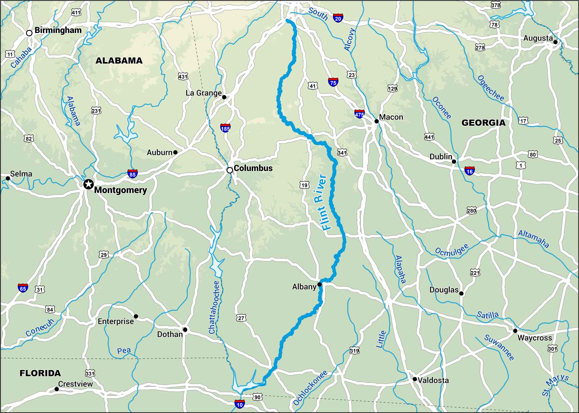
Starting in the rolling hills of Georgia, the Flint winds south toward the Gulf. Use our map to see this river that’s shaped the heart of the state for centuries.
Map Information
On the Map
Interstates: I-10, I-16, I-20, I-65, I-75, I-85, I-185, I-475 Major Highways: US Hwy 1, US Hwy 17, US Hwy 19, US Hwy 23, US Hwy 25, US Hwy 27, US Hwy 29, US Hwy 31, US Hwy 41, US Hwy 78, US Hwy 80, US Hwy 82, US Hwy 84, US Hwy 90, US Hwy 129, US Hwy 221, US Hwy 231, US Hwy 278, US Hwy 280, US Hwy 301, US Hwy 319, US Hwy 341, US Hwy 411, US Hwy 431, US Hwy 441 Major Rivers: Flint River, Chattahoochee River, Alabama River, Cahaba River, Pea River, Conecuh River, Ocmulgee River, Oconee River, Ogeechee River, Altamaha River, Satilla River, Suwannee River, St Marys River, Alapaha River, Little River, Alcovy River, South River, Ochlockonee River States: Georgia, Alabama, Florida Cities/Towns: Montgomery, Columbus, Macon, Albany, Dothan, Valdosta, Waycross, Auburn, La Grange, Enterprise, Douglas, Dublin, Augusta, Birmingham, Selma, Crestview
US Maps
Lakes and Rivers Map
Our map of America’s lakes and rivers shows the major waterways that define the country’s landscape.
Waterway Maps
Explore America’s waterways.


