Erie Canal Map
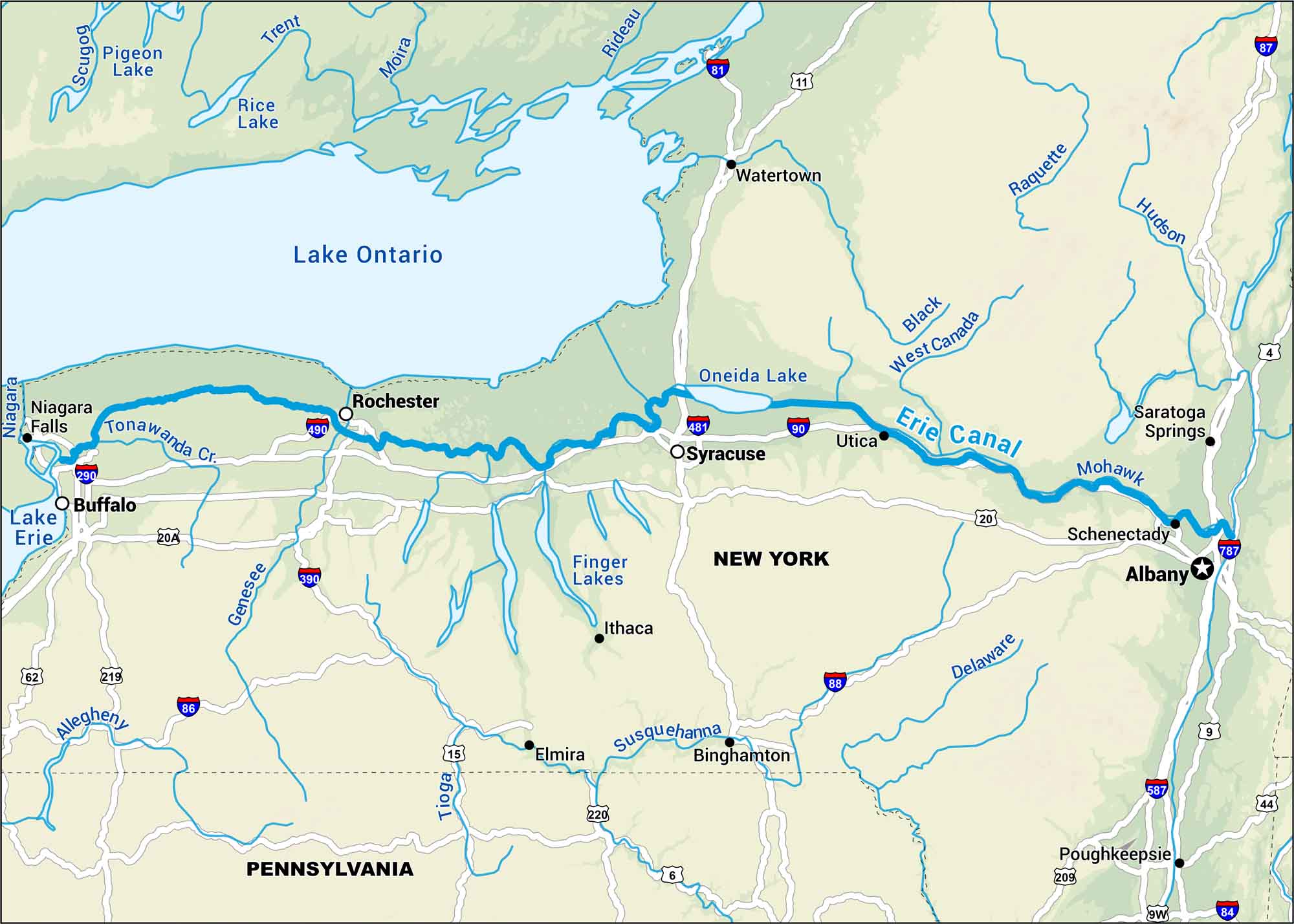
The Erie Canal cuts clear across New York, connecting the Hudson River to Lake Erie. Our map follows its route and the canal towns still thriving along the route. It’s a piece of early America still visible, still alive in upstate life.
Map Information
On the Map
Interstates: I-81, I-84, I-86, I-87, I-88, I-90, I-290, I-390, I-481, I-490, I-587, I-787 Major Highways: US Hwy 6, US Hwy 9, US Hwy 9W, US Hwy 11, US Hwy 15, US Hwy 20, US Hwy 20A, US Hwy 44, US Hwy 62, US Hwy 209, US Hwy 219, US Hwy 220 Rivers/Lakes: Erie Canal, Lake Erie, Lake Ontario, Hudson River, Mohawk River, Delaware River, Susquehanna River, Genesee River, Tioga River, Black River, West Canada River, Raquette River, Niagara River, Tonawanda Cr, Oneida Lake, Finger Lakes, Pigeon Lake, Rice Lake States: New York, Pennsylvania Cities/Towns: Albany, Buffalo, Rochester, Syracuse, Utica, Schenectady, Binghamton, Elmira, Ithaca, Poughkeepsie, Watertown, Niagara Falls, Saratoga Springs
US Maps
Lakes and Rivers Map
Our map of America’s lakes and rivers shows the major waterways that define the country’s landscape.
Waterway Maps
Explore America’s waterways.


