Coosa River Map
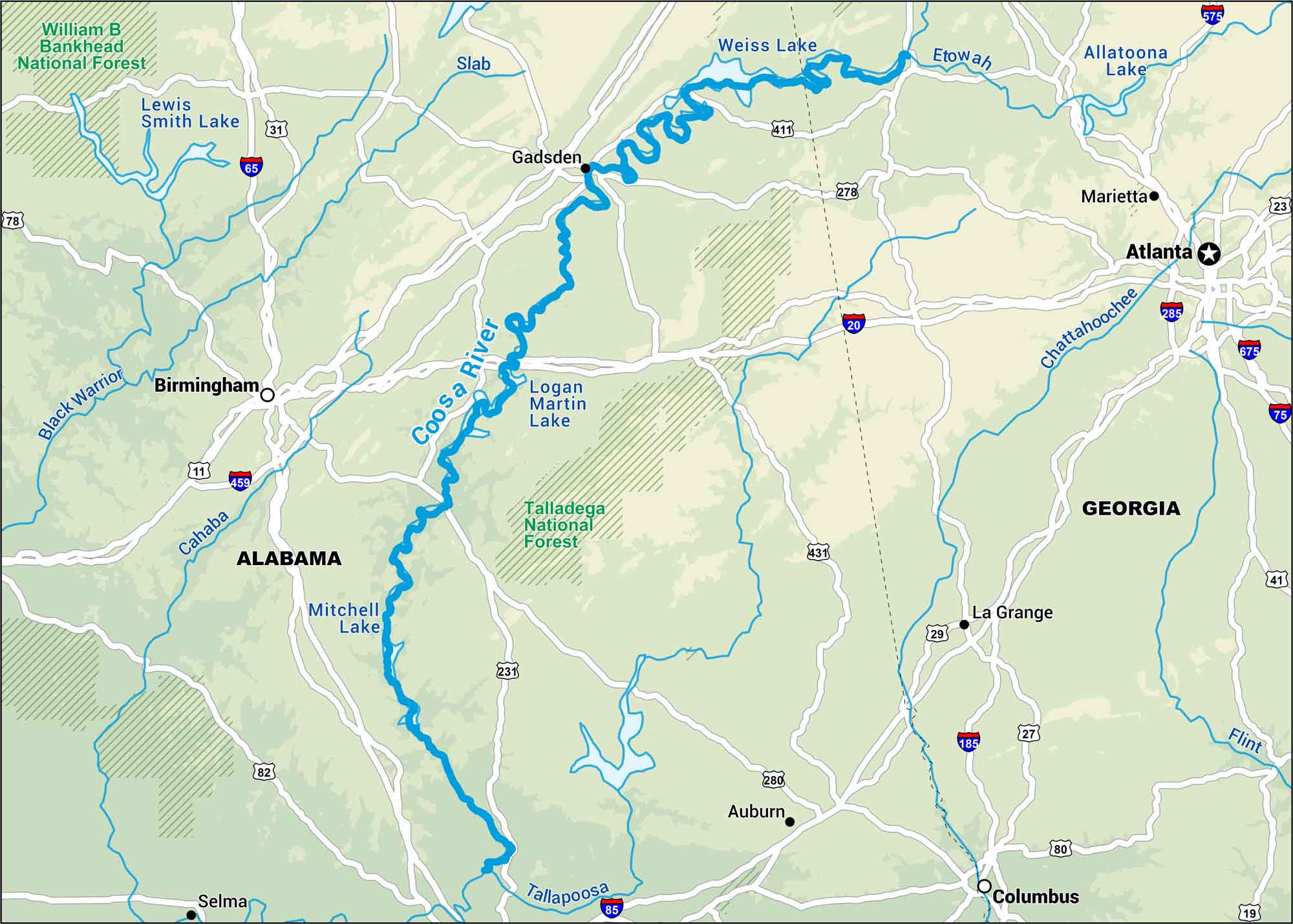
Our map of the Coosa River outlines its broad bends and crossings, from Wetumpka to Gadsden. The Coosa River runs across Alabama’s rolling hills in the heart of the state.
Map Information
On the Map
Interstates/Highways: I-20, I-59, I-65, I-75, I-85, I-185, I-285, I-459, I-575, I-675 Major Roads: US Hwy 11, US Hwy 19, US Hwy 23, US Hwy 27, US Hwy 29, US Hwy 31, US Hwy 41, US Hwy 78, US Hwy 80, US Hwy 82, US Hwy 231, US Hwy 278, US Hwy 280, US Hwy 411, US Hwy 431 Rivers/Lakes: Coosa River, Lewis Smith Lake, Weiss Lake, Logan Martin Lake, Mitchell Lake, Tallapoosa, Slab, Black Warrior, Cahaba, Etowah, Allatoona Lake, Chattahoochee, Flint Major Forests: William B Bankhead National Forest, Talladega National Forest States: Alabama, Georgia Cities/Towns: Birmingham, Atlanta, Gadsden, Marietta, La Grange, Auburn, Columbus, Selma
US Maps
Lakes and Rivers Map
Our map of America’s lakes and rivers shows the major waterways that define the country’s landscape.
Waterway Maps
Explore America’s waterways.


