Columbia River Map
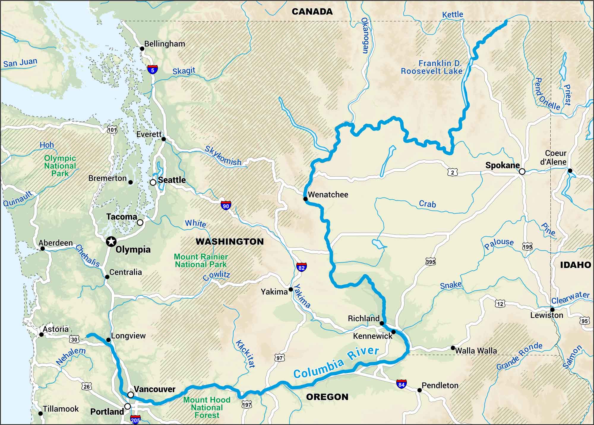
The Columbia River starts in the Canadian Rockies and carves through Washington and Oregon. Eventually, it reaches the Pacific Ocean. Our map maps out cities and highways that near this historic river
Map Information
On the Map
Interstates/Highways: I-5, I-82, I-84, I-90, I-205 Major Roads: US Hwy 2, US Hwy 12, US Hwy 30, US Hwy 95, US Hwy 97, US Hwy 101, US Hwy 195, US Hwy 395, State Rte 26, State Rte 197 Rivers/Lakes: Columbia River, Franklin D. Roosevelt Lake, Skagit, Skykomish, Okanogan, Kettle, Pend Oreille, Priest, White, Cowlitz, Crab, Pine, Palouse, Snake, Clearwater, Yakima, Klickitat, Nehalem, Chehalis, Hoh, Quinault, Salmon, Grande Ronde Parks/Forests: Olympic National Park, Mount Rainier National Park, Mount Hood National Forest States: Washington, Oregon, Idaho Cities/Towns: Seattle, Portland, Tacoma, Vancouver, Spokane, Olympia, Bellingham, Everett, Bremerton, Yakima, Wenatchee, Richland, Kennewick, Walla Walla, Lewiston, Coeur d’Alene, Pendleton, Longview, Astoria, Tillamook, Aberdeen, Centralia
US Maps
Lakes and Rivers Map
Our map of America’s lakes and rivers shows the major waterways that define the country’s landscape.
Waterway Maps
Explore America’s waterways.


