Chattahoochee River Map
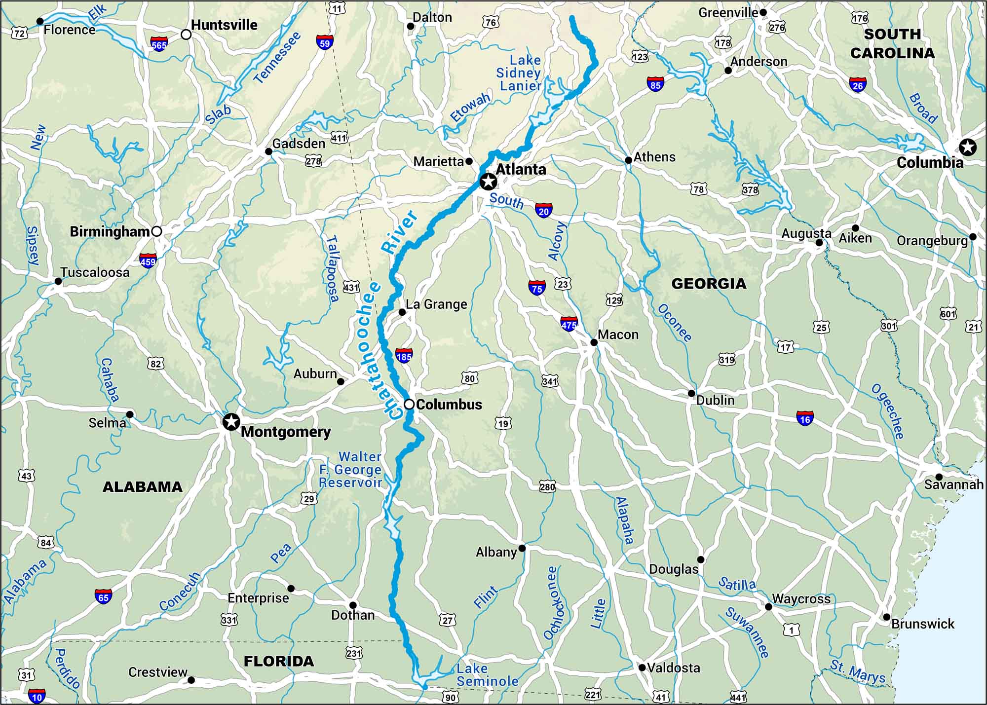
From the Blue Ridge down through Atlanta, the Chattahoochee winds through it all. The map lays down the ground rules of the Chattahoochee River. Half wild, half urban. But all southern.
Map Information
On the Map
Interstates: I-10, I-16, I-20, I-59, I-65, I-75, I-85, I-185, I-475, I-565 Major Highways: US Hwy 1, US Hwy 11, US Hwy 17, US Hwy 19, US Hwy 23, US Hwy 25, US Hwy 27, US Hwy 29, US Hwy 31, US Hwy 41, US Hwy 72, US Hwy 76, US Hwy 78, US Hwy 80, US Hwy 82, US Hwy 84, US Hwy 129, US Hwy 221, US Hwy 231, US Hwy 278 Rivers/Lakes: Chattahoochee River, Lake Sidney Lanier, Walter F. George Reservoir, Lake Seminole, Tennessee, Slab, Elk, New, Sipsey, Cahaba, Tallapoosa, Etowah, South, Alcovy, Oconee, Ogeechee, Flint, Ochlockonee, Little, Alapaha, Satilla, Suwannee, St. Marys, Conecuh, Pea, Alabama, Perdido Cities/Towns: Atlanta, Columbus, Montgomery, Birmingham, Huntsville, Marietta, La Grange, Auburn, Gadsden, Dalton, Athens, Augusta, Aiken, Orangeburg, Columbia, Macon, Dublin, Savannah, Albany, Douglas, Waycross, Brunswick, Valdosta, Dothan, Enterprise, Crestview, Florence, Tuscaloosa, Selma
US Maps
Lakes and Rivers Map
Our map of America’s lakes and rivers shows the major waterways that define the country’s landscape.
Waterway Maps
Explore America’s waterways.


