Home » State Maps » Washington Physical Map

Washington Physical Map

Washington Physical Map

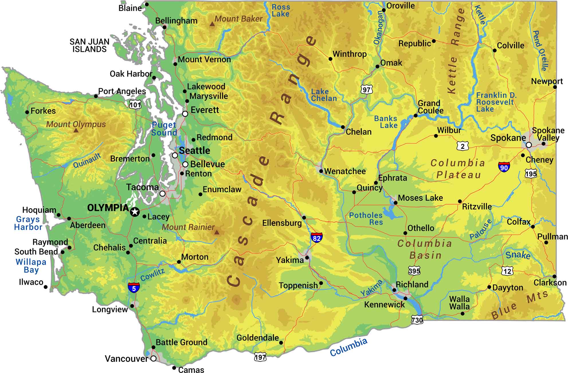
Without further ado, I bring to you our physical map of Washington. The Cascade Range divides Washington into wet and dry. Rainforests and coastline are on the Pacific side. Whereas desert and plains are on the interior side. Mount Rainier stands over 14,000 feet. We’re also showing Mount Olympus and Baker too.

Map Information

  • State of Washington
  • Physical Map of Washington
  • Free for personal and commercial purpose. Attribution is required. How to attribute?

On the Map

Washington Location Map
Physical Features: Cascade Range, Mount Olympus, Blue Mts, Columbia Plateau, Columbia Basin, Kettle Range, Mount Rainier, Mount Baker State Capital: Olympia Major Cities: Bellevue, Everett, Seattle, Spokane, Tacoma Cities and Towns: Aberdeen, Bellingham, Blaine, Bremerton, Camas, Centralia, Chehalis, Chelan, Cheney, Clarkson, Colfax, Colville, Dayton, Ellensburg, Enumclaw, Ephrata, Forkes, Goldendale, Grand Coulee, Hoquiam, Ilwaco, Kennewick, Lacey, Lakewood, Longview, Marysville, Morton, Moses Lake, Mount Vernon, Oak Harbor, Omak, Oroville, Othello, Pasco, Port Angeles, Pullman, Quincy, Raymond, Redmond, Renton, Richland, Ritzville, South Bend, Spokane Valley, Toppenish, Vancouver, Walla Walla, Wenatchee, Wilbur, Winthrop, Yakima Interstate Highways: I-5, I-82, I-90, I-205, I-405, I-705 US Routes: US-2, US-12, US-97, US-101, US-195, US-197, US-395, US-730 Lakes and Reservoirs: Banks Lake, Franklin D. Roosevelt Lake, Lake Chelan, Potholes Reservoir, Ross Lake, Puget Sound Rivers and Streams: Columbia River, Cowlitz River, Kettle River, Palouse River, Quinault River, Snake River, Yakima River

References

  1. Shuttle Radar Topography Mission Elevation
  2. National Map TopoBuilder Application

Leave a Reply

Your email address will not be published. Required fields are marked *