Oklahoma Physical Map
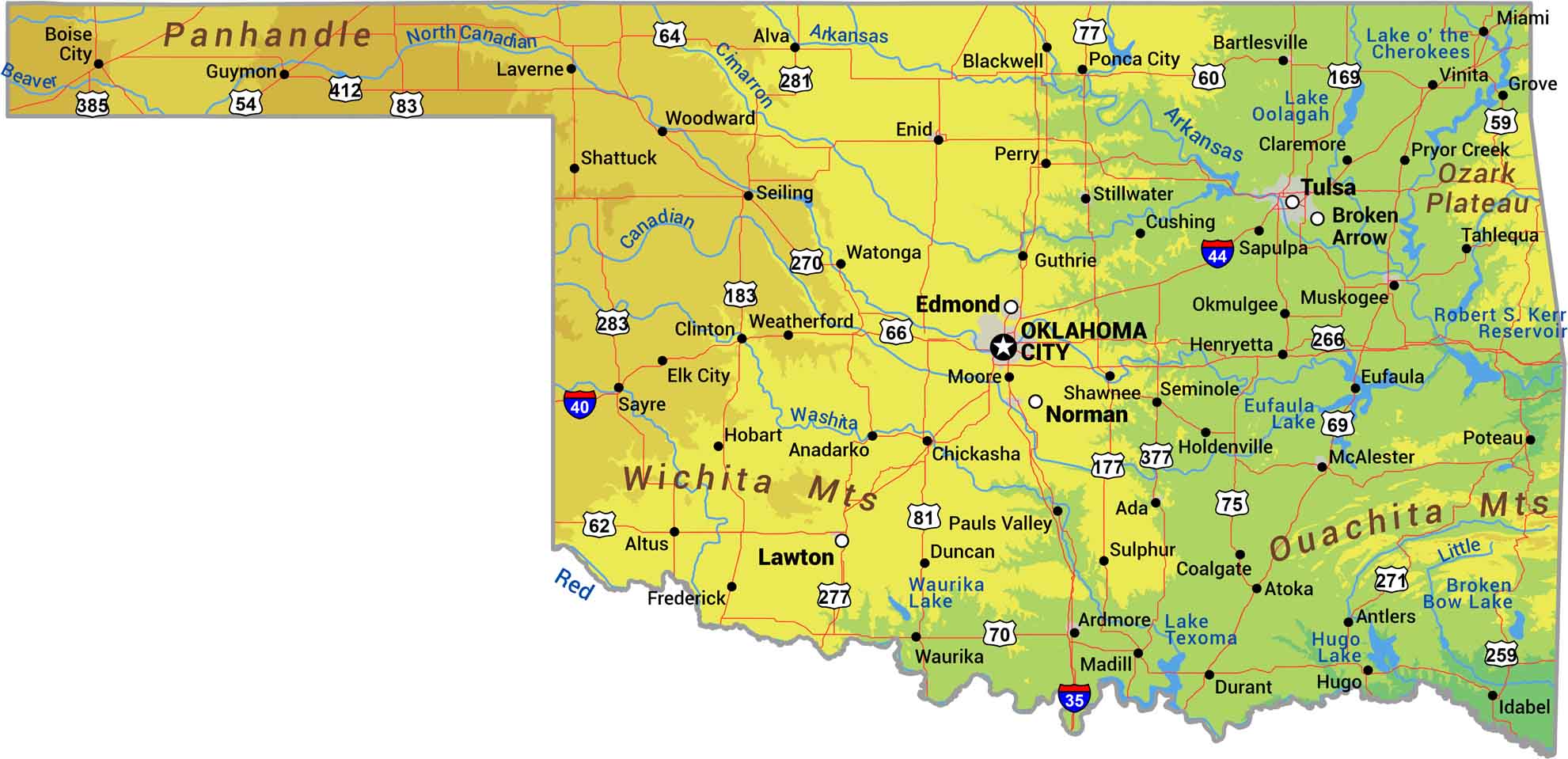
Have a look at Oklahoma’s four distinct regions squeezed into one state. The Ozark and Ouachita Mountains bring forests and ridges to the east, while the central plains roll with prairie. Western Oklahoma flattens into High Plains grassland and the panhandle stretches into pure shortgrass country. Our physical map of Oklahoma shows the South, Southwest, and Great Plains.
Map Information
On the Map
Physical State Maps
Select any state map below to view its physical map.


Oklahoma State Maps
Here is our map collection of the Sooner State.


