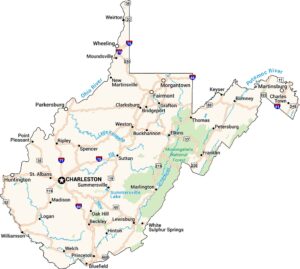
West Virginia Physical Map
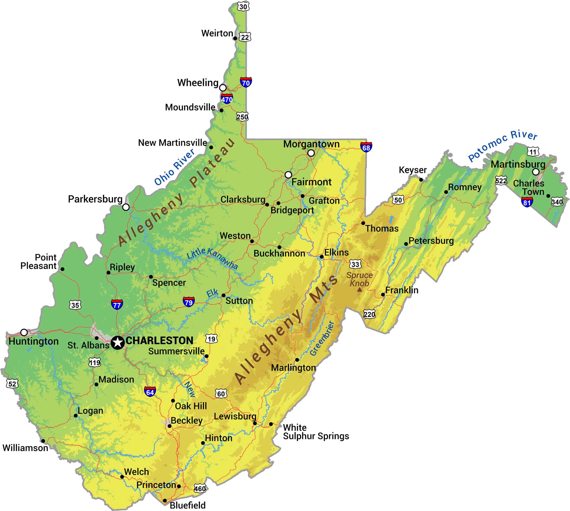
There’s a reason they call it the Mountain State. West Virginia is nothing but Appalachian ridges and valleys. The Allegheny Mountains run through the eastern side. The Ohio River forms the western border and rivers like the New and Kanawha flow through. Our physical map of West Virginia shows some of the most rugged terrain east of the Rockies.
Map Information
On the Map
Physical State Maps
Select any state map below to view its physical map.


West Virginia State Maps
Browse our maps of the state of West Virginia.